Trans Canada Trail
The Trans Canada Trail is a national network of recreational pathways spanning the country from the Atlantic to the Pacific and Arctic oceans. Conceived in 1992 as a legacy project for Canada's 125th anniversary, the trail has grown into the world's longest multi-use recreational trail network, stretching over 28,000 kilometres. It is a community-driven project, with individual sections developed, owned, and maintained by local organizations, municipalities, and governments, supported by the nonprofit Trans Canada Trail organization. The trail serves as a significant piece of national infrastructure for outdoor activity, connecting countless communities and presenting Canada's diverse landscapes.
Origins and Development
The idea for the Trans Canada Trail was born from the Canada 125 celebrations in 1992, envisioned as a lasting national legacy similar to other international greenway networks like EuroVelo routes or the United States Numbered Bicycle Routes. Development has been a massive, decentralized effort involving thousands of volunteers, community groups, corporations, and all levels of government. The nonprofit Trans Canada Trail organization raises funds and provides support but does not own or operate any trail sections, which remain under local control. A major milestone was reached on August 26, 2017, when the trail was officially declared connected from coast to coast to coast, celebrated with events across the country.
The first province to complete its designated section was Prince Edward Island, with its Confederation Trail. Funding has come from a mix of federal and provincial government contributions alongside significant corporate and individual donations. A notable development strategy has been the repurposing of defunct railway lines donated by Canadian Pacific and Canadian National Railway, emulating the Rails-to-Trails model used in the United States where corridors are 'rail banked' for potential future rail use. This approach has created long, continuous greenways like the Newfoundland T'Railway, an 883-kilometre linear park on a former railbed.
In September 2018, the federal government announced a $30 million investment over four years for trail development and enhancement, as announced by then-Minister of Environment and Climate Change Catherine McKenna. The organization's stated plans include making the trail more accessible, replacing interim roadways with off-road greenways, adding new spurs and loops, and funding emergency repairs for sections damaged by natural disasters. The trail's connection in 2017 marked a beginning for these enhancement goals rather than a final conclusion for the network. The trail is an ensemble project that might be one of the largest volunteer efforts ever undertaken in Canada.
Trail Composition and Use
The Trans Canada Trail is a multi-modal network comprising greenways, waterways, and roadways. Its composition varies dramatically across the country, with only about 32 percent, or roughly 7,898 kilometres, consisting of dedicated off-road trails. The remainder includes road shoulders, highways, and water routes, with some large sections simply following highways like the Alaska and Dempster highways. This mixed nature means the trail accommodates different users depending on the section, including hikers, bicyclists, horseback riders, cross-country skiers, and snowmobilers.
The main route generally runs through Canada's southern, more populous regions, connecting major cities, with a significant northern arm branching from Alberta through Edmonton, northern British Columbia, and into the Yukon. Officially, the trail route is shown going from Winnipeg across the northern Prairies into Alberta east of Edmonton, spawning a northern walking trail near Fort Saskatchewan before entering Edmonton, then going south to Calgary and west to British Columbia. Amenities like shelters and water sources are intended to be spaced along the route, but their availability is inconsistent and depends entirely on local management. The trail's official eastern 'Kilometre 0' is located at Cape Spear, Newfoundland and Labrador, the most easterly point in continental North America, with a marker also located outside the Railway Coastal Museum in St. John's. The multi-use design means that a traveller attempting a complete cross-country journey cannot rely on a single mode of transportation, needing to switch between walking, cycling, and paddling to traverse the various trail, road, and water sections. This fundamental characteristic differentiates it from classic pure-hiking trails and makes cycling more suitable for many of the on-road stretches. Not all of the off-road trails are for hiking only, as some allow motorized access like the Newfoundland T'Railway or the Iron Horse Trail in Alberta which permits quads and horses.
- Off-road trails: Approximately 7,898 km (32% of total network).
- Primary users: Hikers, cyclists, equestrians, cross-country skiers, snowmobilers.
- Northern route: Branches from Alberta through northern BC to the Yukon and Arctic Ocean.
- Eastern terminus: Cape Spear, Newfoundland and Labrador.
- Multi-modal requirement: A through-trekker needs multiple transportation methods including canoe.
- Highway sections: Include significant stretches like Alberta's Highway 2A between Edmonton and Calgary.
- Motorized access: Allowed on some rail-trail sections like in Newfoundland and Alberta.
Notable Provincial and Regional Sections
The character of the Trans Canada Trail changes significantly as it passes through each province and territory, reflecting local geography and trail development priorities. In Newfoundland and Labrador, the route begins with the rugged East Coast Trail before following the 883-kilometre Newfoundland T'Railway, a linear park on a former railbed that permits motorized access. The detailed route passes through communities like Holyrood, Whitbourne, Clarenville, Gander, Grand Falls-Windsor, and Deer Lake, ending at Port aux Basques for the ferry to Nova Scotia. The last stretch in Newfoundland is called the Wreckhouse Trail, passing through Osmond and Grand Bay to the ferry terminal.
Prince Edward Island's portion of the Trans Canada Trail is known as the Confederation Trail. The main section runs from Tignish at kilometre 0 to Elmira at kilometre 273. Spurs extend to Charlottetown, Souris, Murray Harbour, and the Confederation Bridge in Borden-Carleton. In Nova Scotia, the trail includes the Celtic Shores Coast Trail on Cape Breton Island. The only trail in Halifax is the Halifax Boardwalk, which travels from Pier 21 to near Casino Nova Scotia. In Dartmouth, trails include the Dartmouth Waterfront Trail and the Shubie Canal Greenway, which visits parks like Shubie Park.
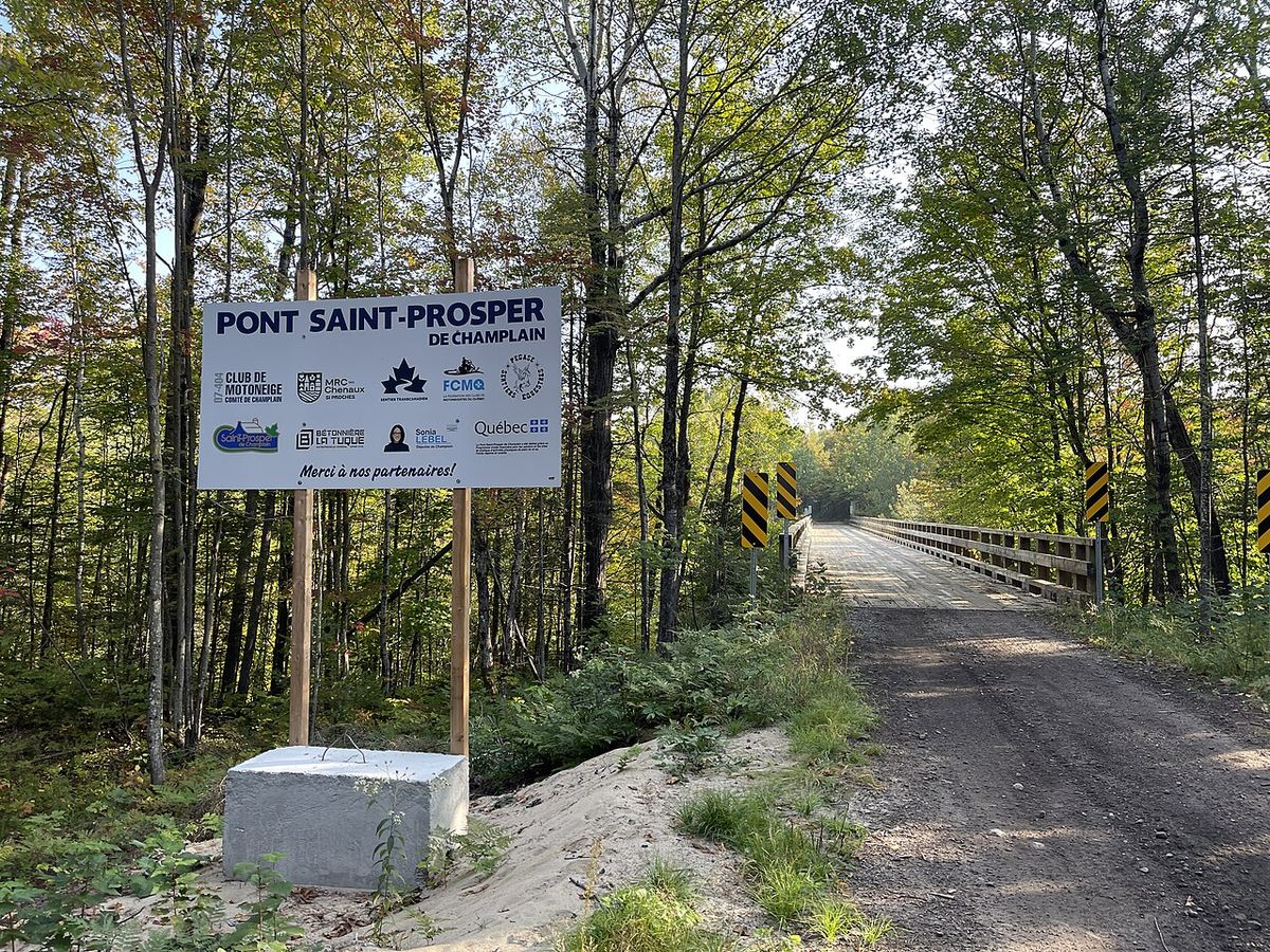
In New Brunswick, the Shogomoc River Pedestrian Bridge is an 81 metre suspension bridge that is part of the Trans Canada Trail. It was opened in October 2011 with journalist Valerie Pringle present as a Trans Canada Trail representative. The Sentier NB Trail network provided over 300,000 dollars towards the project. It is known as the final non-motorized trail link between Grand Bay Westfield and the border of Quebec. Much of the trail's current route through Quebec follows the Route Verte and has many cycling paths. Completed off-road hiking trails can be found in Gatineau Park and along a route linking the Papineau-Labelle Nature Reserve, Mont Tremblant Provincial Park, and the Mastigouche Nature Reserve.
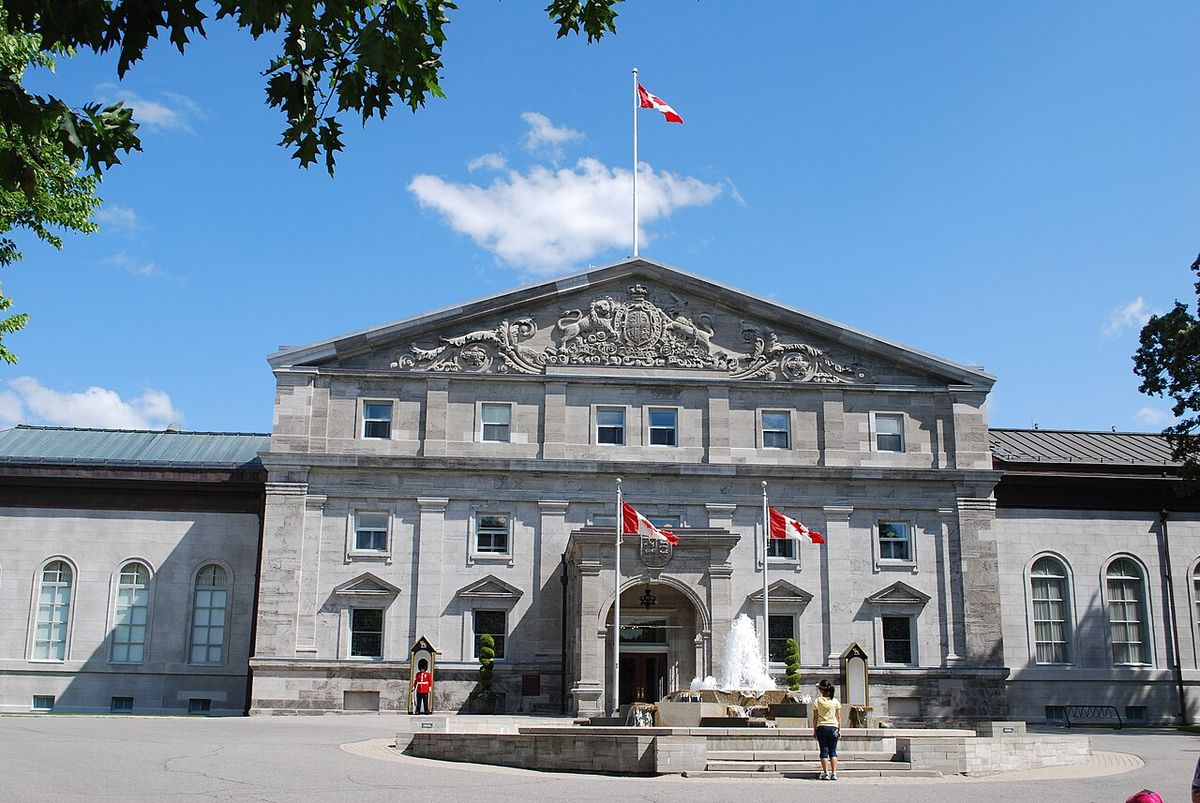
In Ontario, the Pan Am Path helps complete the 250 kilometres of gaps in Ontario's portion of the Trans Canada Trail as a legacy project of the 2015 Pan American Games. In 2013, a one kilometre long honorary segment of the Trans Canada Trail was opened on the grounds of Rideau Hall in Ottawa. The Lake Huron North Channel Waterfront route reduces use of shoulders along the Trans Canada Highway by about 50 kilometres. The route through Manitoba is a mix of off-road hiking trails, road shoulders, and waterways. Saskatchewan uses rural gravel roads to link off-road hiking trails and avoids major highways and paved roads.
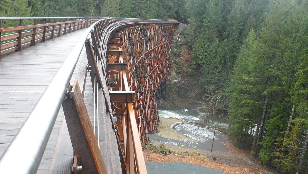
Alberta has faced challenges with significant highway sections, including a major stretch on busy Highway 2A between Edmonton and Calgary, and opposition from special interest groups. East of Edmonton, the trail uses the Iron Horse Trail on the old Canadian Northern Railway route from Elk Point to Waskatenau, allowing use by foot, quad, and horse. At Athabasca, the northern walking trail spawns a water trail down the Athabasca River to the Mackenzie River and the Arctic Ocean. In British Columbia, the trail follows the Kettle Valley Rail Trail including the very popular Myra Canyon portion, and passes through Sparwood, the Okanagan Valley, and Princeton.
- Newfoundland and Labrador: East Coast Trail and Newfoundland T'Railway (883 km railbed).
- Prince Edward Island: Confederation Trail (main line: Tignish to Elmira, 273 km).
- New Brunswick: Shogomoc River Pedestrian Bridge (opened 2011, final link to Quebec).
- Quebec: Integrated with the Route Verte cycling network. Hiking trails in Gatineau Park.
- Ontario: Pan Am Path helped complete 250 km of gaps. Rideau Hall segment (2013).
- Alberta: Includes highway sections. Iron Horse Trail railbed. Northern branch leads to Athabasca and the Arctic via water trail.
- British Columbia: Follows Kettle Valley Rail Trail including Myra Canyon. Passes through Sparwood, Okanagan Valley, Princeton.
Governance, Funding, and Future Goals
The Trans Canada Trail is a nonprofit group that raises funds for the continued development of the trail. However, the trail is owned and operated at the local level. The network is made up of more than 400 community trails, with each section developed, owned, and managed locally by trail groups, conservation authorities, and by municipal, provincial, territorial, and federal governments. Thousands of Canadians, community partner organizations, corporations, local businesses, and all levels of government are involved. As an ensemble, the Trans Canada Trail might be one of the largest volunteer projects ever undertaken in Canada. The organization plans to replace interim roadways with off-road greenways to make it safer and more accessible.
Future objectives also include adding new trail spurs and loops, and establishing an emergency fund for repairs to sections damaged by natural disasters. The 2018 federal investment of $30 million is directed toward these development goals over a four-year period. The organization continues to work with local partners to improve trail quality and accessibility, acknowledging that the network's completion in 2017 was a beginning for its evolution. The trail's development emulated the successful Rails-to-Trails initiative in the United States, converting transportation corridors for recreational use while keeping the option for future rail conversion. The Alberta government's role, for instance, has largely been to assist local trail associations in searching for better routes rather than imposing a single standard.
Analysis and Criticism
The trail has faced criticism for diverging from an original vision of a continuous, off-road recreational corridor built far enough from roads to mask traffic noise. Political scientist Edmund A. Aunger, a professor emeritus at the University of Alberta, argues the trail is a 'confusing and dangerous hodgepodge' of incompatible pathways, including mountain-bike paths, roadside ditches, dirt ruts, gravel roads, and hazardous ATV trails. The core of the criticism centres on safety and uniformity, as only about a third of the network is composed of dedicated off-road trails, with the rest requiring sharing space with vehicles on roads. Aunger's critique is given weight by personal tragedy. His wife, Elizabeth Ann Sovis, was killed in 2012 while cycling on a roadway section of the trail in Prince Edward Island.
This event highlights a fundamental difference between the Trans Canada Trail and dedicated long-distance hiking trails like the Appalachian Trail. The Trans Canada Trail's mixed-use, multi-modal nature means it does not offer a uniform wilderness experience and often requires road travel, making it more suitable for cycling on many stretches. Not all off-road sections are for hiking only, and the inclusion of waterways means no single mode of transportation is sufficient for a cross-country trek. The criticism points to a lack of uniform standards and central control over the trail's development, which is inherent in its locally owned and managed structure.
The Trans Canada Trail does not own or operate any section of the trail. The organization provides support to local partners and volunteer groups who maintain individual sections. This local ownership and lack of uniform standards has led to criticism. A critic states the trail includes a confusing and dangerous hodgepodge of paths. Only 32 percent of the Trans Canada Trail consists of actual off-road trails, making it fundamentally very different from classic pure-hiking trails. The variability from section to section, and particularly from province to province, is wide.
Detailed Route Examples and Infrastructure
Examining specific route details reveals the varied and complex nature of the trail's construction. In Newfoundland, after leaving Cape Spear, the route follows the coastline to Fort Amherst, connects with the Grand Concourse walkway network, and follows a sidewalk along Southside Road in St. John's to the Railway Coastal Museum. It then travels south and west through communities like Mount Pearl, Paradise, and Conception Bay South, following the former railbed across the island. The trail's name changes frequently along this route, from East Coast Trail to Grand Concourse to Newfoundland T'Railway to specific corridor names like the Gambo to Terra Nova Trail and the Exploits Valley and Beothuk Trail before ending at the Port aux Basques ferry.
In British Columbia, the main leg enters from Alberta following the Elk River through Sparwood and the Kootenay and Columbia mountains. It passes through the Okanagan Valley over the Kettle Valley Rail Trail, including the Myra Canyon portion. Officially, the route between Brookmere and the Othello Tunnels follows the old Vancouver, Victoria and Eastern Railway and Kettle Valley Railway, but due to lost bridges and washouts, it actually traces the Coquihalla Highway before descending via the Silverhope logging road and Paleface Pass into the Chilliwack Lake basin. This illustrates how practical realities sometimes divert the trail from ideal off-road corridors.
Infrastructure projects are critical for connectivity. In New Brunswick, the Shogomoc River Pedestrian Bridge was opened with a ribbon-cutting ceremony attended by journalist and TCT representative Valerie Pringle. In Alberta, multi-use trails in Fort Saskatchewan and Sturgeon County plan to connect with a new pedestrian bridge spanning the North Saskatchewan River, funded as part of a project to twin Highway 15. In Saskatchewan, the route was proclaimed complete with the opening of the Wakamow Valley Suspension Bridge, though parts still require a canoe or small boat for waterway sections. The trail in Nova Scotia's Cape Breton region begins in North Sydney after the ferry from Newfoundland, with a planned route through the town and across Highway 125 following Old Branch Road.
| Province/Territory | Key Trail Sections/Names | Notable Characteristics and Challenges |
|---|---|---|
| Newfoundland and Labrador | East Coast Trail, Newfoundland T'Railway | Begins at Cape Spear. 883 km rail-trail. Detailed route through numerous communities. Ends at Port aux Basques ferry. |
| Prince Edward Island | Confederation Trail | Fully developed, island-wide crushed stone trail. First completed provincial section. Site of 2012 cyclist fatality. |
| Nova Scotia | Celtic Shores Coast Trail, Salt Marsh Trail, Halifax Boardwalk | Includes ferry connection from NL. Boardwalk in urban Halifax. Trail network in Dartmouth including Shubie Canal Greenway. |
| New Brunswick | Sentier NB Trail network, Shogomoc River Bridge | 81m suspension bridge (2011) completed key link. Over $300,000 from Sentier NB Trail. |
| Quebec | Route Verte, Gatineau Park trails | Cycling network backbone. Planned hiking route from Ottawa-Gatineau to Gaspé and NB border. |
| Ontario | Pan Am Path, Rideau Hall segment, Lake Huron water route | Games legacy project filled 250 km gap. Honorary segment at Governor General's residence. Water route reduces highway use. |
| Manitoba | Mixed trails, road shoulders, waterways | Combination of all three types with no single dominant form. |
| Saskatchewan | Gravel road links, Wakamow Valley Bridge | Avoids major highways. Uses gravel roads. Proclaimed complete with bridge opening. Includes canoe waterways. |
| Alberta | Highway 2A, Iron Horse Trail, Northern walking trail | Significant highway portions. Rail-trail east of Edmonton. Northern fork to Athabasca and Arctic water trail. |
| British Columbia | Kettle Valley Rail Trail, Myra Canyon, Coquihalla Hwy | Popular rail-trail sections. Passes through Okanagan. Official route diverted to highway due to degradation. |
| Yukon | Northern arm from BC | Extension of the northern walking trail route toward the Arctic Ocean. |
The trail is multi-use and depending on the section may allow hikers, bicyclists, horseback riders, cross country skiers, and snowmobilers. In theory, the trail is equipped with regularly spaced pavilions that provide shelter and fresh water, but this varies widely from section to section and from province to province. The main section runs along the southern areas of Canada, connecting most major cities. There is also a long northern arm that runs through Alberta to Edmonton and then up through northern British Columbia to the Yukon. Large sections of the trail, however, are simply highways.
Safety, Accessibility, and User Considerations
The safety profile of the Trans Canada Trail is directly tied to its mixed composition. The portions that run along roadways, particularly highways with narrow shoulders and heavy traffic like Alberta's Highway 2A, present clear risks to cyclists and pedestrians. The criticism from Edmund A. Aunger focuses on this lack of separation from vehicular traffic, which was contrary to an early vision of a trail built away from roads. The 2012 death of Elizabeth Ann Sovis on a PEI roadway section is a sombre reminder of these inherent dangers in shared spaces. Aunger specifically states that the trail includes hazardous ATV trails and other potentially dangerous pathways due to a lack of uniform standards and control.
Accessibility varies not only by province but by individual trail section, influenced by local maintenance budgets and volunteer capacity. The promise of regularly spaced pavilions with shelter and water is not a national standard but a local aspiration, leading to an inconsistent experience for long-distance travellers. For users with mobility challenges, the suitability of the trail depends entirely on the specific section, as rugged wilderness paths, gravel railbeds, and paved road shoulders each present different barriers. The trail's multi-use designation means some sections are shared with motorized users like snowmobilers or quad riders, which can affect the experience and safety of non-motorized users.
Users must carefully plan their mode of travel based on the segments they intend to traverse. Hiking is only practical for the off-road portions, which constitute less than a third of the network. Cycling becomes a necessary and often safer option for the extensive road and hard-surface sections. For the waterway components, such as those in Saskatchewan or on the northern water trail from Athabasca to the Arctic Ocean, a canoe or small boat is required. This requirement for multiple transportation modes makes through-trekking a complex logistical undertaking rather than a simple long-distance walk. The trail's official connection in 2017 did not resolve these fundamental planning challenges for users attempting a coast-to-coast journey.
Questions about Trans Canada Trail
How long is the Trans Canada Trail?
The Trans Canada Trail stretches over 28,000 kilometres across Canada, making it the longest recreational multi-use trail network in the world. It connects the Atlantic, Pacific, and Arctic oceans. The trail was officially declared connected on August 26, 2017. Its length includes a mix of greenways, waterways, and roadways, with large sections simply following existing highways like the Alaska and Dempster highways.
Can you hike the entire Trans Canada Trail?
Hiking the entire Trans Canada Trail is not feasible as a single-mode journey. Only about 32 percent of the route, or 7,898 kilometres, is dedicated off-road trail. The remainder consists of road shoulders, highways, and water routes. A through-trekker would need to use multiple modes of transportation, including cycling for road sections and paddling for waterways. The trail is not a continuous wilderness footpath like the Appalachian Trail, and not all off-road sections are for hiking only.
What is the Confederation Trail?
The Confederation Trail is Prince Edward Island's portion of the Trans Canada Trail. It is a fully developed, crushed stone trail that runs 273 kilometres from Tignish to Elmira. The trail features numerous spurs to communities like Charlottetown, Souris, Murray River, and the Confederation Bridge in Borden-Carleton. It was the first provincial section of the Trans Canada Trail to be completed and is exclusively for non-motorized use, though it was the site of a fatal cycling accident in 2012.
Who owns and maintains the Trans Canada Trail?
The Trans Canada Trail is not owned by a single entity. Individual sections are developed, owned, and managed locally by over 400 community trail groups, conservation authorities, and municipal, provincial, and federal governments, for instance in parks like Gatineau Park. The national Trans Canada Trail nonprofit organization raises funds, provides support, and coordinates the network, but it does not own or operate any trail segments. Maintenance is carried out by these local partners and volunteers in what might be one of Canada's largest volunteer projects.
What was the Great Trail?
The Great Trail was a rebranding of the Trans Canada Trail used between September 2016 and June 2021. After this nearly five-year period, the name was changed back to the original Trans Canada Trail. The name change did not alter the route, management, or composition of the trail network, which continued its operations and development under the nonprofit Trans Canada Trail organization throughout that period. The trail was still primarily funded by governments and donors regardless of the name used.
Where does the Trans Canada Trail start and end?
The official eastern terminus or 'Kilometre 0' of the Trans Canada Trail is at Cape Spear, Newfoundland and Labrador, the most easterly point in continental North America, with a marker also at the Railway Coastal Museum in St. John's. The trail then winds across the country to the Pacific Ocean in British Columbia and has a northern arm reaching through Alberta, BC, and the Yukon toward the Arctic Ocean via a water trail from Athabasca. It is a network with multiple routes rather than a single point-to-point path. This cross Canada system of greenways, waterways, and roadways stretches from the Atlantic to the Pacific to the Arctic oceans. The main section runs along southern Canada connecting major cities, while a long northern arm runs through Alberta to Edmonton and up through northern British Columbia to the Yukon. The trail extends over 28000 kilometres, making it the longest recreational, multi use trail network in the world.
Sources and further reading
- Trans Canada Trail (Wikipedia)
- Adventure Awaits on the Trans Canada Trail (tctrail.ca)
Checked by the Garbutt Disposal desk. Last updated 2026-10-21.