Petitcodiac River
The Petitcodiac River is a significant waterway in southeastern New Brunswick, known for its distinctive brown colour and historical tidal bore. Flowing 79 kilometres through Westmorland, Albert, and Kings counties, it drains a watershed of approximately 2,071 square kilometres into Shepody Bay and the Bay of Fundy. The river's ecological health and unique hydrology have been central to environmental debates, particularly following the 1968 construction of a causeway that severely impacted its ecosystem. In recent years, the Petitcodiac has also become a prominent venue for endurance sports, hosting major running events that utilize its scenic riverfront trails and parks.
Geography and Hydrology
The Petitcodiac River originates from the confluence of the Anagance and North rivers in western Westmorland County, with the Anagance draining 81 square kilometres and the North River draining 264 square kilometres. It flows southeastward, passing under Route 106 at the community of Petitcodiac and receiving the Pollett River, with a 314 square kilometre watershed, near River Glade. Further downstream, it is joined by the Little River, formerly the Coverdale River, which drains 275 square kilometres near Salisbury, and by Turtle Creek as it approaches the Greater Moncton area. Near Moncton, the river makes a distinctive 90-degree bend, a feature that gave the city its original Acadian name, Le Coude, meaning The Elbow, and historically widened to 1.6 kilometres through the city before the causeway was built. The river continues past Dieppe and Hillsborough, eventually joining the Memramcook River, which has a 412 square kilometre watershed, and widening into the 122 square kilometre Shepody Bay wetland before reaching the Bay of Fundy.
The river's hydrology is dominated by the immense tides of the Bay of Fundy, which historically created a notable tidal bore documented by British Lieutenant Colonel George Scott in November 1758. Before the construction of the causeway in 1968, this retrograde wave ranged from one to two metres in height and travelled upstream at speeds between five and 13 kilometres per hour, with its noise noted in 1825 to terrify animals. The average yearly discharge at the causeway is 27.3 cubic metres per second, with recorded extremes ranging from a high of 730 cubic metres per second in 1962 to a low of 0.36 cubic metres per second in 1966. The river's distinctive brown colour, which earned it the nickname Chocolate River, is a result of heavy sedimentation from its mud floor, a condition worsened by the causeway which trapped an additional 10 million cubic metres of silt downstream within three years. The watershed receives an average of 1,100 millimetres of precipitation yearly, with summer temperatures averaging 17.5 degrees Celsius and winter temperatures averaging minus 7.5 degrees Celsius.
The Causeway and Environmental Impact
The construction of the Petitcodiac River Causeway in 1968 was a major event that dramatically altered the river's ecosystem. Built between Moncton and Riverview to prevent agricultural flooding and provide a road crossing, the rock-and-earth fill structure blocked all but 100 metres of the river's flow. In the first three years after construction, an estimated 10 million cubic metres of silt accumulated in the 4.7-kilometre stretch downstream from the causeway. This sedimentation, combined with the restriction of fish passage, led to an 82 percent reduction in regional salmon catches and severely degraded water quality. The causeway also diminished the tidal bore, reducing its height to between five and 75 centimetres, and contributed to the river being listed as Canada's most endangered by Earthwild International in 2003, after being ranked second behind the Rupert River in 2002.
A concerted restoration effort began, culminating in the permanent opening of the causeway gates in April 2010 as part of a $68 million project. This action initiated the flushing of ocean silts from the river and allowed the tidal bore to begin recovering its former size. The causeway was fully replaced by a bridge in September 2021, reconnecting the river's flow and marking a major step in its ecological rehabilitation. Water quality monitoring, conducted by groups like the Petitcodiac Watershed Alliance, has shown variable conditions, with a 2009 study noting E. coli levels above recreationally safe limits in summer months and occasional failures to meet safe thresholds for nitrates and phosphates. A 2007 provincial report indicated the watershed did not meet guidelines for E. coli in 10 percent of samples, for dissolved oxygen in 5 percent, and for pH in 3 percent, though nitrate levels were consistently safe.
Other environmental issues have included contamination from a 35-hectare landfill operated near the river until 1992, where leachate samples showed ammonium levels 15 times above guidelines and contained heavy metals and PCBs, causing 100 percent mortality in test trout and daphnia. The City of Moncton pleaded guilty to related charges in 2003 and paid a $35,000 fine, while the engineering firm Gemtec Limited was fined $6,000 in 2006. Potential threats from uranium mining near Turtle Creek, the location of Greater Moncton's water reservoir, prompted environmental groups to call for a ban, leading the province to restrict such mining to 300 metres from residential areas and ban it from protected drinking water zones. The Petitcodiac Watershed Alliance has also highlighted the impact of agriculture, recommending cattle fencing along streams and a phase-out of cosmetic pesticides, which the Petitcodiac Riverkeeper argues leach into groundwater and should be wholly prohibited with full ingredient disclosure on labels.
Wildlife and Ecological Significance
Historically, the Petitcodiac River supported a rich diversity of aquatic life. Its waters were home to significant populations of Atlantic salmon, American shad, striped bass, Atlantic sturgeon, and Atlantic tomcod, alongside species like gaspereau, brook trout, and American eel. Other fish included blueback herring, brown bullhead, chain pickerel, smallmouth bass, white perch, and white sucker. The river was the only known Canadian habitat for the dwarf wedgemussel, a freshwater mollusc, and also hosted other molluscs like the brook floater and eastern pearlshell. Marine mammals such as harbour seals and porpoises were occasionally present, and the low salinity allowed many aquatic organisms to enter the watershed.
The ecological damage caused by the causeway led to the local extinction of several species by the mid-1980s. The Atlantic salmon, dwarf wedgemussel, striped bass, Atlantic sturgeon, and Atlantic tomcod were all eliminated from the river system. The American shad, which once accounted for two-thirds of Canadian shad landings with annual catches between 0.91 and 2.72 million kilograms, is also gone. A 2005 project by the Petitcodiac Riverkeeper, funded by the Government of Canada's Environmental Damage Fund, assessed that removing the causeway would create a good chance of reintroducing these lost species and an excellent chance of boosting populations of diminished ones. No data has been released specifically for the potential return of Atlantic salmon or striped bass.
The extensive mudflats of Shepody Bay, at the river's mouth, serve as a critical feeding ground for migratory shorebirds. An estimated 50 to 90 percent of the world's population of semipalmated sandpipers, approximately 269,445 birds representing at least 7.7 percent of the global population, stop here to feed on mud shrimp. The area is an Important Bird Area also used by semipalmated plovers (about two percent of the North American population), short-billed dowitchers, red knots, sanderlings, and least sandpipers during their migration to South America. The watershed supports diverse terrestrial species as well, including insects like stoneflies and mayflies, and non-native species such as the black-footed spider and beech scale.
The watershed also supports a variety of forest habitats, with common tree species including red, white, and black spruce, red maple, white birch, and trembling aspen. Jack pine is found in fire-ravaged areas, cedar in bogs over gypsum and limestone, and sugar maple, beech, and yellow birch on higher slopes. The riparian zone houses willows, white spruce, white pine, and speckled alder. A forest analysis noted that the high frequency of aspen stands reveals the degree of historical and recent human disturbance along the Petitcodiac River, with forests covering 80 percent of the watershed, agriculture using a tenth, wetlands three percent, and commercial or residential use just four percent.

The Petitcodiac as a Sports and Recreation Venue
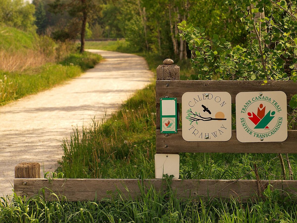
In the 21st century, the restored riverfront and associated trail networks have transformed the Petitcodiac River into a premier venue for endurance sports and community recreation in Atlantic Canada. The scenic Petitcodiac Loop Trail, part of the Trans Canada Trail system, provides a continuous 6.7-kilometre paved and crushed gravel path that circles a section of the river, connecting Moncton and Riverview. This trail crosses two bridges, two boardwalks, and a covered bridge, offering expansive views of the water and surrounding parks. Its development has been instrumental in hosting large-scale athletic events that draw participants from across the region and beyond, capitalizing on the river's central location and natural beauty.
The river's role as a sports hub is exemplified by the Tidal Force Ultra 100, a major endurance running event scheduled for August 22-23, 2026. This dusk-to-dawn race requires participants to complete 15 consecutive 6.7-kilometre loops on the Petitcodiac Loop Trail within 15 hours, starting and finishing at the Riverfront Gazebo on Coverdale Road in Riverview. The event features strict safety protocols for its night sections, including mandatory headlamps, a spare light, a whistle, and a phone. Organizers award a commemorative medal for runners reaching loop seven (47 kilometres) and an Ultra Elite 100 wrist band for those who complete the full 100-kilometre distance within the time limit, with cash prizes for the final-loop sprint.
- Tidal Force Ultra 100: A 100-kilometre night run on August 22-23, 2026, consisting of 15 loops on the Petitcodiac Loop Trail.
- Last Tide Standing Backyard Ultra 2026: A timed ultramarathon event following a backyard ultra format, scheduled for September 19, 2026, along the river trails.
- Unleashed Dog Sports Event: A weekend competition for various dog sports held on June 27-28, 2026, in the community of Petitcodiac.
- Petitcodiac River Walking Tour: A guided tour starting at Bore Park in Moncton, highlighting the tidal bore and river history, offered by Unexpected Moncton Tours.
- Community Running Events: The trail system regularly hosts local running club challenges and training runs, such as the Red & Black Open track meet in Saint John in December 2026.
- Seasonal Festivities: The riverfront area is integrated into events like the Aura holiday experience at the Moncton Market until December 17, 2026, and the annual Santa Claus parade on Main Street.
Beyond organized races, the riverfront is a central location for daily recreation and seasonal festivities. Bore Park in downtown Moncton is a popular vantage point for observing the returning tidal bore, and the river walking tour meets there in front of the large monument. The Riverfront Gazebo at 346 Coverdale Road serves as a key landmark and gathering point for event participants and casual visitors alike. These uses reinforce the river's status as a civic and recreational heart for the Greater Moncton region, blending natural spectacle with community activity.
Event Details and Participant Information
For athletes and visitors, accessing and participating in events along the Petitcodiac River requires attention to specific logistical details. The primary venue for the Tidal Force Ultra 100 is the Riverfront Gazebo located at 346 Coverdale Road in Riverview, New Brunswick. This serves as the start line, finish line, and central hub for the event. The 6.7-kilometre loop course is approximately one-third asphalt and two-thirds fine crushed gravel, with about three-quarters of the route lit during night hours. A dedicated safety checkpoint operates on the Moncton side of the river throughout the night portion of the ultra marathon, and each loop must be completed within one hour or the runner is declared Did Not Finish (DNF).
Prospective participants must register through official race platforms like Race Roster and are advised to confirm all final details, including start times, fees, and course maps, directly with event organizers before registering. The Tidal Force Ultra 100 begins at 7:00 p.m. on Friday, August 22, 2026, with a finish window closing at 10:00 a.m. on Saturday, August 23. Mandatory gear includes a headlamp, a spare light source, a whistle, and a mobile phone. The event structure, where runners must complete each loop within one hour to continue, creates a unique and demanding physical challenge set against the backdrop of the river's nocturnal landscape. Similar events, like the Last Tide Standing Backyard Ultra, also use the river trails but follow different timed-loop formats.
| Event Name | Date (2026) | Distance/Format | Primary Location | Key Details |
|---|---|---|---|---|
| Tidal Force Ultra 100 | August 22-23 | 100 km (15 x 6.7 km loops) | Riverfront Gazebo, Riverview | Night run, 7 p.m. start, 15-hour limit. |
| Last Tide Standing Backyard Ultra | September 19 | Timed Loop Ultra | Petitcodiac River trails | Scenic course along bridges and boardwalks. |
| Unleashed Dog Sports | June 27-28 | Multi-event competition | Petitcodiac, NB | Weekend of dog sports community event. |
| Petitcodiac River Walking Tour | Recurring | Guided walk | Bore Park, Moncton | Focus on tidal bore and local history. |
| Aura Holiday Experience | Thursdays until Dec 17 | Market & festivities | Moncton Market | Evening shopping, crafts, and community gathering. |
Historical and Cultural Context
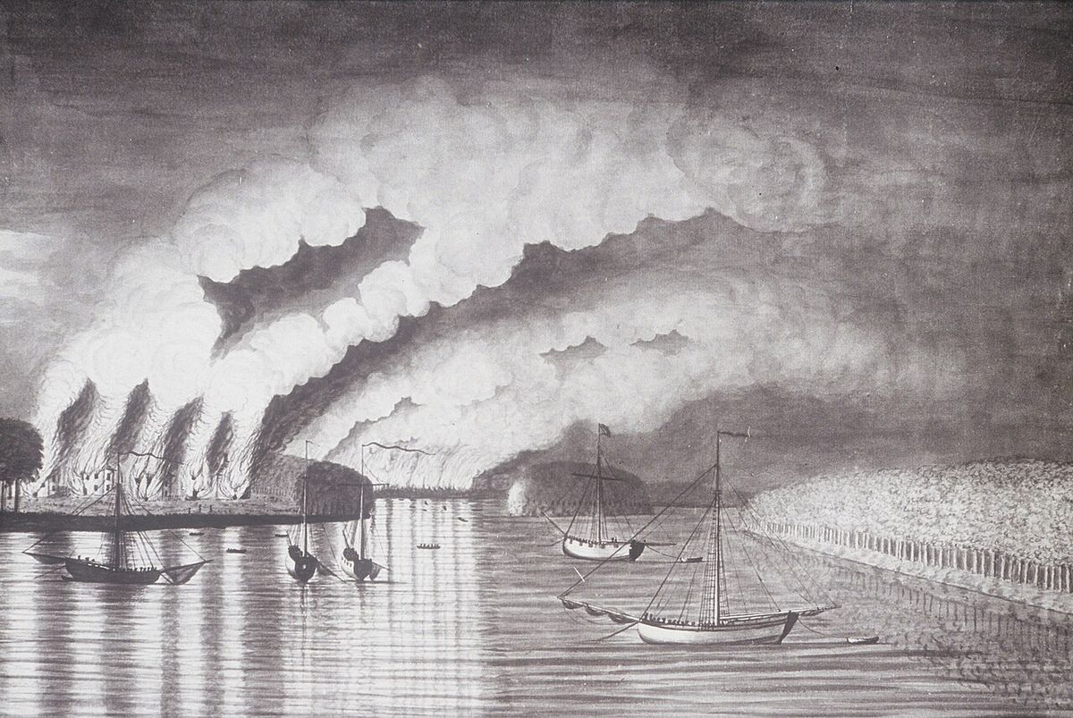
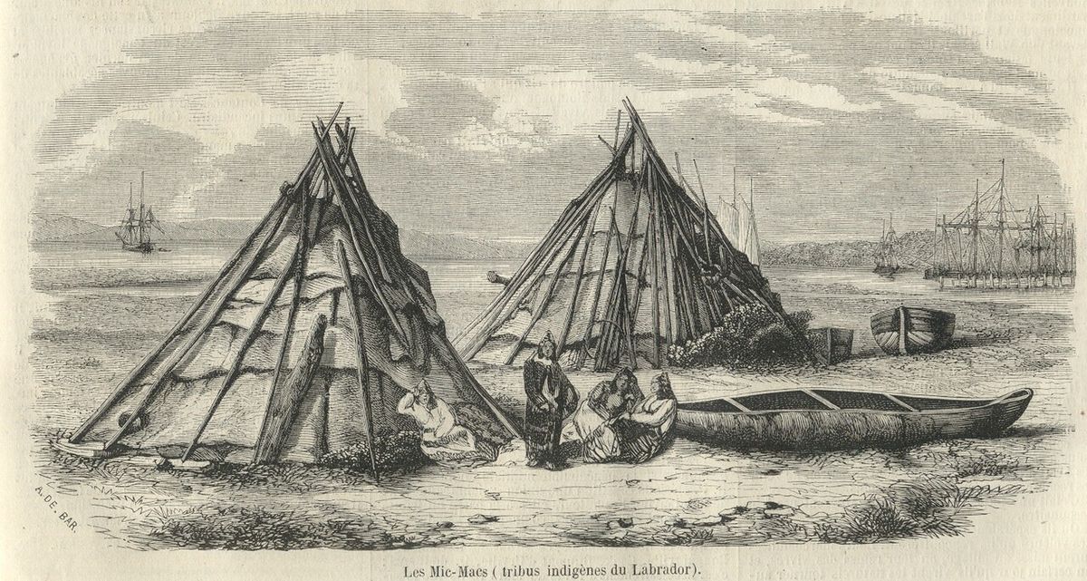
The Petitcodiac River region has been inhabited for millennia, first by the Mi'kmaq, who used it as part of a portage route between Shubenacadie and the village of Petitcodiac, where they had a winter camp. Acadian settlers from Port Royal, Nova Scotia, colonized the region in 1698, but were expelled in 1755 during the Seven Years' War. During this period, Acadian resistance fighters based at Village-des-Blanchard, now Hillsborough, fought under French leader Charles Deschamps de Boishébert in the Battle of Petitcodiac, attempting to repel British troops but suffering the destruction of most of their settlement. Three years later, British troops returned to launch the Petitcodiac River Campaign, cementing British control over the area.
In the 1840s, the Greater Moncton area experienced a shipbuilding boom, which was halted following the arrival of the steam train, leading to the town's de-incorporation. These changes gradually marginalized the Petitcodiac River. The actual derivation of the river's name is rooted in an indigenous word, likely from Wolastoqey or possibly Mi'kmaq language. According to Wolastoqey Elder and linguist Dr. Peter Paul, the name refers to a wall of water rushing in, meaning 'sound of thunder'. If the term has a Mi'kmaq origin, it could be linked to 'Petkootkweăk', meaning 'the river that bends like a bow'. The Acadians adapted the name to Petcoudiac or Petitcoudiac, which was later modified to Petitcodiac by British settlers. A commonly held belief suggests the name originates from the French term 'petit coude', meaning 'little elbow', but this is not the actual derivation.
The Mi'kmaq were the first to settle near the river, using it as part of a portage route. In 1698, the region was colonized by Acadians from Port Royal, Nova Scotia, but they were later expelled in 1755 during the Seven Years' War. During this period, Acadian resistance fighters fought in the Battle of Petitcodiac. In 1968, a controversial rock-and-earth fill causeway was constructed between Moncton and Riverview. On 14 April 2010, the causeway's gates were opened permanently as part of a restoration project. The causeway was replaced with a bridge, completed in September 2021. With the opening of the causeway gates, the river is flushing itself of ocean silts, and the tidal bore is returning to its former size.
Questions about Petitcodiac River
What is the tidal bore on the Petitcodiac River?
The tidal bore is a wave that travels upstream twice daily, caused by the extreme tides of the Bay of Fundy pushing into the river estuary. Before the causeway was built in 1968, the bore was one of the world's largest, ranging from one to two metres high and moving at speeds of 5 to 13 kilometres per hour, with its noise noted to terrify animals in 1825. The causeway severely reduced the bore's size to between five and 75 centimetres, but since the gates were opened in 2010 and the causeway replaced with a bridge in 2021, the bore has been recovering. It remains a popular natural spectacle, best viewed from Bore Park in downtown Moncton, and was first mentioned in European records by British Lieutenant Colonel George Scott in 1758.
Where does the Tidal Force Ultra 100 race take place?
The Tidal Force Ultra 100 is run entirely on the Petitcodiac Loop Trail, a 6.7-kilometre multi-use path that circles a section of the Petitcodiac River, connecting Riverview and Moncton. The race starts and finishes at the Riverfront Gazebo located at 346 Coverdale Road in Riverview. Participants run 15 consecutive loops of this trail, which consists of one-third asphalt and two-thirds fine crushed gravel, crosses two bridges and boardwalks, and offers views of the river, with about three-quarters of the course lit at night. The event is scheduled for August 22-23, 2026, beginning at 7:00 p.m. and finishing by 10:00 a.m. the next day, with a mandatory safety checkpoint on the Moncton side during night hours.
Why was the Petitcodiac River called the most endangered river in Canada?
In 2003, the environmental organization Earthwild International designated the Petitcodiac River as Canada's most endangered river due to the severe ecological damage caused by the 1968 causeway. The structure blocked fish passage, led to massive siltation of 10 million cubic metres downstream within three years, reduced the tidal bore, and caused water quality to plummet. These changes resulted in an 82 percent drop in salmon catches and the local extinction of several species, including the Atlantic salmon and the dwarf wedgemussel, the river's only known Canadian habitat. This designation helped galvanize public support for the river's restoration, which began with opening the causeway gates in 2010 as part of a $68 million project.
What fish species were lost from the Petitcodiac River?
Six aquatic species disappeared from the Petitcodiac River following the construction of the causeway. The most significant losses include the Atlantic salmon, the American shad, the striped bass, and the Atlantic sturgeon. The river was also the only known Canadian habitat for the dwarf wedgemussel, which is now found only in nine watersheds in the United States. The Atlantic tomcod was also eliminated. The American shad was a particular favourite, representing two-thirds of all Canadian shad landings from 1870 to 1900 with annual catches peaking between 0.91 and 2.72 million kilograms. A 2005 assessment indicated that restoring the river's flow through causeway removal provided a good chance of reintroducing these lost species to the ecosystem.
What is the significance of Shepody Bay to the Petitcodiac River?
Shepody Bay is the expansive estuary where the Petitcodiac River empties into the Bay of Fundy. It is a critically important wetland area, covering 122 square kilometres, that provides essential habitat for migratory shorebirds. An estimated 50 to 90 percent of the world's population of semipalmated sandpipers, along with millions of other birds like semipalmated plovers and red knots, stop here to feed on mud shrimp during their annual migration from the Arctic to South America. Specifically, around 269,445 sandpipers, representing at least 7.7 percent of the global population, use this site. The health of the Petitcodiac River directly influences the water quality and ecological productivity of this vital bay, which is part of a larger system including the Cumberland Basin and Chignecto Bay.
How long is the Petitcodiac Loop Trail used for running events?
The Petitcodiac Loop Trail is 6.7 kilometres long. This specific distance is used for ultramarathon events like the Tidal Force Ultra 100, which takes place in Riverview, New Brunswick. The scenic trail winds along the Petitcodiac River, offering views as runners traverse bridges, parks, and boardwalks. The course circles a section of the river between the town of Riverview and the city of Moncton. This loop format is central to backyard ultra style races where runners must complete the loop within a set time to continue.
Sources and further reading
- Petitcodiac River (Wikipedia)
- Events (moncton.ca)
- The Community of Three Rivers (threeriversnb.ca)
Checked by the Garbutt Disposal desk. Last updated 2026-10-26.