West Coast Trail
The West Coast Trail is a 75-kilometre coastal backpacking trail on the southwestern edge of Vancouver Island in British Columbia, recognized as one of the world's premier and most challenging hiking routes. Originally constructed in 1907 as the Dominion Lifesaving Trail to aid shipwreck survivors in the treacherous Graveyard of the Pacific, it is now a celebrated component of Pacific Rim National Park Reserve. Managed by Parks Canada, the trail operates under a strict reservation system from May 1 to September 30, drawing thousands of experienced backpackers annually to its rugged, spectacular scenery. Its demanding terrain, rich history, and deep cultural significance to local First Nations make it a definitive Canadian wilderness experience.
Historical Origins and Development
The West Coast Trail traverses the traditional territories of the Pacheedaht, Ditidaht, Huu-ay-aht, and Nuu-chah-nulth peoples, who have inhabited the region for over 4,000 years. European activity increased in the 1800s with the establishment of a telegraph line and a rise in maritime traffic, which led to numerous shipwrecks in the area known as the Graveyard of the Pacific. The catastrophic wreck of the SS Valencia in January 1906, with the loss of over 100 lives, spurred the Canadian government to implement a comprehensive lifesaving plan. This plan included constructing the Dominion Lifesaving Trail along the coast to link lifesaving infrastructure. The government built a new lighthouse at Pachena Point and established five wireless telegraph stations along the British Columbia coast, with one located on the trail at Pachena Point. A series of eight shelters were constructed at intervals along the trail, each stocked with survival provisions and a telegraph, and the Bamfield Lifeboat Station was equipped with an innovative motor lifeboat. The trail served its original purpose for decades before being incorporated into the newly created Pacific Rim National Park in 1973, transitioning from a rescue route to a recreational hiking destination.
In the 1970s, a lack of regulation led to issues with hikers trespassing on culturally sensitive First Nations archaeological sites and reserves. Modern management now requires hikers to stay on the designated path through these areas, and the Ditidaht First Nation offers guided tours to provide respectful access to historical sites. The trail's infrastructure has been continuously upgraded, though it remains subject to severe coastal weather, as demonstrated by major storm damage in the winter of 2006 to 2007 that required significant federal funding for repairs. The trail's operational history also includes the vital role of lighthouse keepers at Pachena Point and Carmanah Point, whose presence aided hiker safety for over a century. In July 2024, the Canadian Coast Guard announced plans to de-staff these light stations due to geotechnical concerns, a decision that has prompted concern from the lightkeepers' union and local communities.
Trail Route and Physical Characteristics
The linear trail runs between two primary trailheads: Pachena Bay near the community of Bamfield in the north, and the Gordon River near Port Renfrew in the south. Hikers can also access the trail's midpoint via a water taxi from Balaats’adt (Nitinaht Village) across the Nitinat Narrows for a fee. The official length is listed as 75 kilometres, but due to rerouting and variations between beach and forest travel, GPS data from hikers indicates the actual distance is between 80 and 92 kilometres. The southern section from Gordon River to Nitinat Narrows, approximately 33 kilometres, is widely considered the most technically challenging portion of the hike. This area features relentless mud, complex route-finding, and some of the trail's most formidable ladder descents and river crossings. In contrast, the northern section from Nitinat Narrows to Pachena Bay, roughly 42 kilometres, offers more beach walking and relatively faster progress, culminating in the long, flat stretch of Pachena Beach.
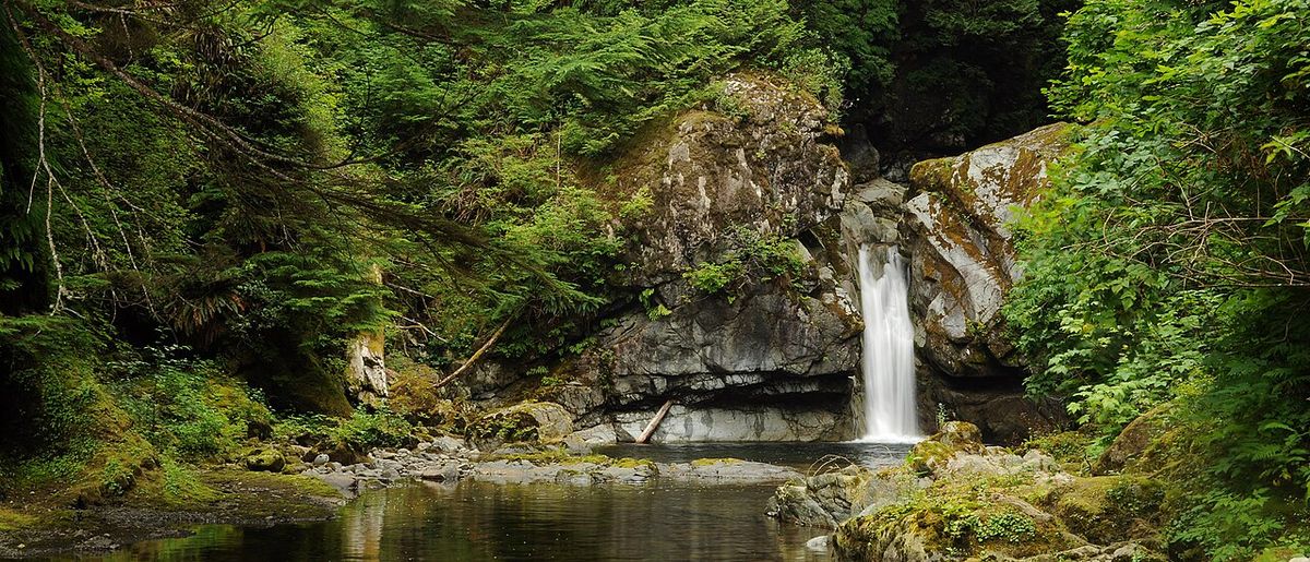
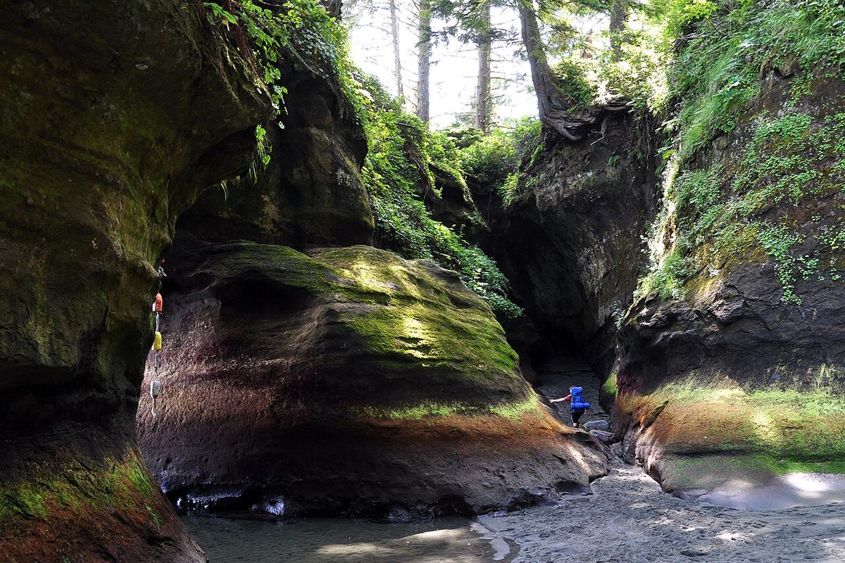
The terrain is exceptionally varied and demanding, blending coastal and rainforest environments. Hikers travel through dense old-growth forests, deep bogs, and across slippery boardwalks. The route frequently emerges onto sand and pebble beaches, requiring careful attention to tide tables as many coastal sections become impassable during high tide. To bypass dangerous surge channels and impassable headlands, the trail diverts inland, often involving steep climbs and descents on wooden ladders. Parks Canada classifies the West Coast Trail as a remote Type 3 trail, warning hikers to expect and prepare for deteriorated infrastructure. Hikers must be prepared for missing or rotten boardwalks with exposed nails, non-functioning cable cars, downed trees, and ladder systems that may be missing consecutive rungs. The trail's difficulty is compounded by the region's famously wet and windy weather, which can cause delays and heighten the risk of hypothermia.
Key Infrastructure and Navigational Challenges
Completing the West Coast Trail requires using a series of unique man-made structures designed to overcome the rugged landscape. The trail is famous for its extensive ladder systems. An audit in 2023 documented 109 ladders comprising 2,673 individual rungs, with some structures reaching heights of over 30 feet. Five cable cars provide safe passage across larger, fast-flowing rivers when fording is unsafe, with the longest spanning Walbran Creek. Four significant suspension bridges cross deep gorges, including the 113-metre-long Logan Creek bridge completed in 2019, which sits 40 metres above the creek. Two waterways, the Gordon River at the southern terminus and the Nitinat Narrows near the midpoint, are too wide for cables and require a ferry service operated by local First Nations.
Hikers must carry and consult detailed tide tables issued by Parks Canada, as strategic timing is crucial for safe beach travel. The trail features designated campgrounds at regular intervals, equipped with bear-proof food storage boxes and outhouses, though these sites can become crowded. For resupply, there are only two commercial locations along the entire route where food can be purchased. At kilometre 32, the Nitinat Narrows ferry operator sells fresh seafood like salmon and crab. Further south, near the Carmanah Lighthouse, a concession called Nytom (formerly Chez Monique's) sells burgers and drinks, though its operation can be intermittent as supplies are packed in by the operator. Beyond these points, hikers must be entirely self-sufficient, carrying all necessary food, gear, and first-aid supplies for the multi-day journey.
- Cable Car Crossings: Camper Creek, Cullite Creek, Walbran Creek (longest), Carmanah Creek, Klanawa River.
- Major Suspension Bridges: Logan Creek (113 m), Cheewhat Creek, Billy Goat Creek, Tsocowis Creek.
- Ferry Crossings: Gordon River (south trailhead) and Nitinat Narrows (midpoint).
- Resupply Points: Nitinat Narrows ferry (seafood) and Nytom near Carmanah Point (burgers).
Permits, Regulations, and Planning
Access to the West Coast Trail is tightly controlled by Parks Canada to preserve the wilderness experience and ensure hiker safety. The trail is only open for overnight use from May 1 to September 30 each year, and all hikers must obtain a permit through a competitive reservation system. For the 2026 season, reservations opened at 8:00 AM Pacific Time on January 19, with popular summer dates typically selling out within hours. The daily quota is strictly limited to 75 hikers, divided between the two main trailheads, with a portion of permits sometimes reserved for last-minute cancellations. The total cost for a permit involves several fees. The overnight trail use fee for 2025 was $25.75, but this is supplemented by a reservation fee and mandatory ferry crossing fees, bringing the total estimated cost per person between $250 and $280.
Before setting foot on the trail, every member of a hiking party is required to attend a mandatory 90-minute orientation session at their chosen trailhead. This session covers critical safety information, including wildlife protocols, tide management, emergency procedures, and the principles of Leave No Trace. Parks Canada provides clear guidance on who should and should not attempt the hike, strongly discouraging those without prior multi-day backpacking experience. The agency recommends that a minimum of one person per group carry bear spray due to increased reports of human-wildlife interactions. Also, all hikers must be prepared for the possibility of extended trips, as injuries, severe weather, or unsafe river conditions can delay progress for several days.
Wildlife and Natural Environment
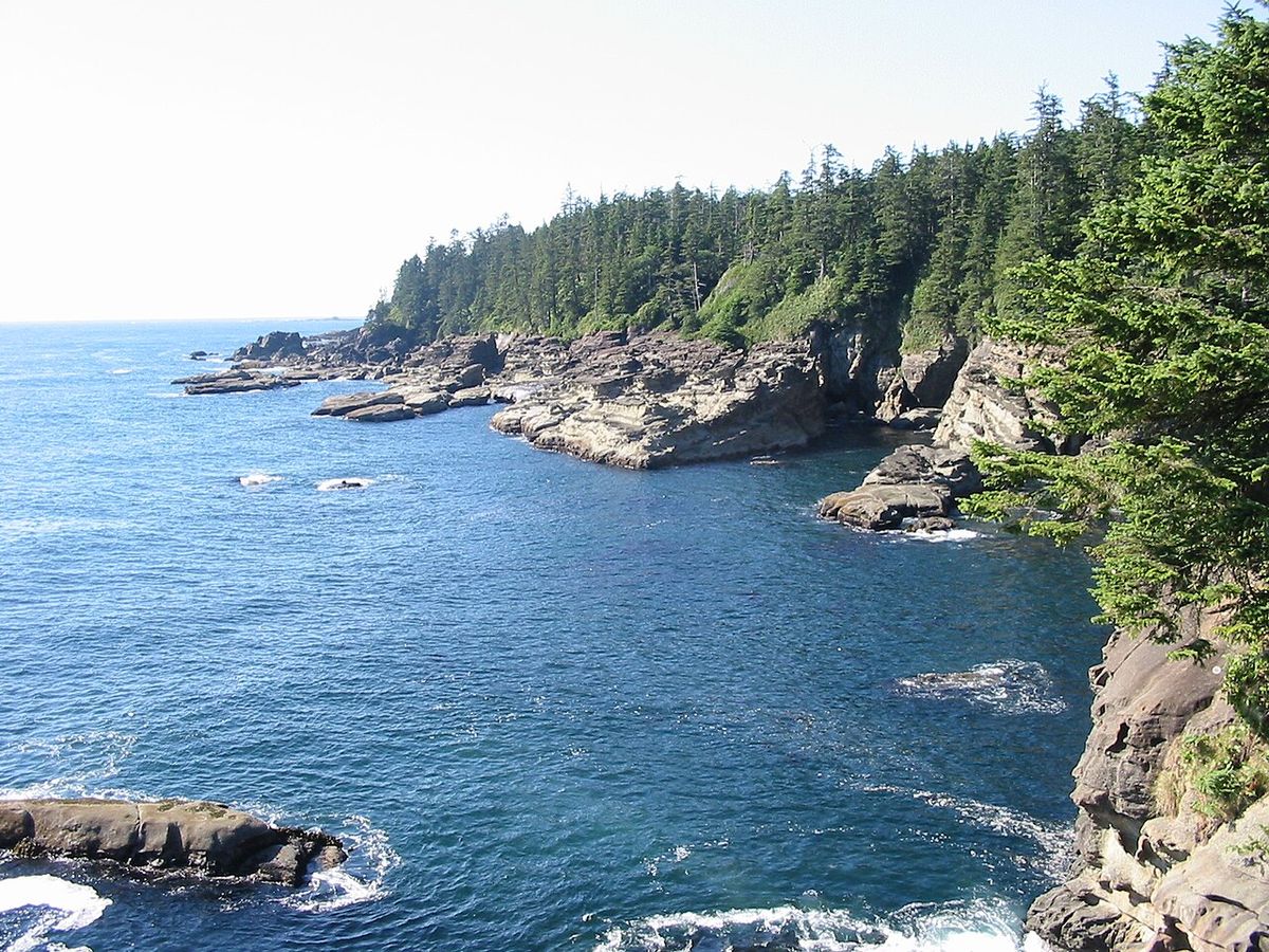
The trail offers a deep immersion in the temperate rainforest and rich marine ecosystems of Vancouver Island's outer coast. The forest interior is dominated by ancient Sitka spruce and cedar, some over 800 years old, while the coastline features dramatic sea stacks, sea caves accessible at low tide, and waterfalls that cascade directly onto beaches. The intertidal zones are filled with active tide pools hosting anemones, molluscs, and starfish. This diverse habitat supports an array of wildlife commonly observed by hikers. Black bears, cougars, and wolves inhabit the forest, while bald eagles are a constant presence overhead. The offshore waters are frequented by Pacific grey whales, orcas, seals, and sea lions, and river estuaries are often visited by hummingbirds.
Encounters with wildlife require caution and respect. The mandatory orientation session instructs hikers on how to react to potential encounters with dangerous animals like bears and cougars. During certain seasons, hikers may encounter seal pups on the beaches and are warned not to approach them, as this can cause the mother to abandon her young. The overarching rule is to observe all wildlife from a safe distance, ensuring both hiker safety and the protection of the animals. The trail's environment is dynamic and can change rapidly with weather, making awareness of natural conditions as important as awareness of wildlife.
Preparation and Safety Considerations
Successfully completing the West Coast Trail demands significant physical preparation and backcountry competency. Parks Canada explicitly states the trail is not for casual hikers and recommends 4 to 6 months of dedicated training for those not already in peak hiking condition. A realistic training regimen should include hiking 3 to 4 days per week for several months prior, with at least two multi-day practice trips carrying a full backpack. The agency emphasizes that experienced group leaders cannot compensate for inexperienced hikers, and all members of a party must be proficient in multi-day backpacking. Hikers must be capable of carrying a heavy pack containing all necessary gear for up to eight days through extremely rugged conditions.
The trail presents numerous specific hazards that require skill to manage. Hikers must be prepared to climb over 100 ladder systems with their pack, trudge through deep mud, and wade across cold, fast-flowing rivers. Weather is a constant factor, with heavy wind and rain capable of causing hypothermia even in summer. Approximately 1 to 2 percent of the 6,000 annual hikers require emergency evacuation due to injury, illness, or hypothermia. Safety hinges on flexibility, as hikers may need to wait days for river levels to drop after heavy rain. Parks Canada provides a clear checklist of disqualifying factors, advising against the hike for anyone with serious medical conditions, recurring joint injuries, or for children under the age of 12, with no permits issued to children under 6.
- Essential Skills: Proficiency in multi-day backpacking, river crossing, using tide tables, and operating cable cars.
- Required Fitness: Ability to hike 8-16 km daily for 6-8 days with a heavy pack over technical terrain.
- Critical Gear: Bear spray (recommended), waterproof layers, sturdy boots, tide tables, and a comprehensive first-aid kit.
- Key Safety Practice: Attending the mandatory Parks Canada orientation session before starting the hike.
Recent Developments and Trail Management
Parks Canada continuously manages the West Coast Trail to balance preservation, safety, and accessibility. A significant recent development was the announcement in July 2024 by the Canadian Coast Guard to de-staff the historic Pachena Point and Carmanah Point lighthouses due to geotechnical concerns, with lightkeepers scheduled to be moved off-site by winter 2024. This decision has been met with concern from the lightkeeper union and local First Nations, who cite the keepers' long-standing role in hiker safety and a lack of consultation. The heritage buildings will remain under the care of Fisheries and Oceans Canada, but the area is currently closed to the public by Superintendent Order. Trail management also adapts to immediate conditions. Parks Canada has issued advisories recommending hikers postpone trips during periods of particularly poor weather or hazardous trail conditions.
The reservation system itself evolves, with the process for the 2026 season confirming the January opening date and the intense competition for permits. The trail's infrastructure is under constant maintenance and upgrade, a necessity highlighted by the major storm damage in 2006 to 2007 that downed thousands of trees and destroyed bridges. While structures are rebuilt, the wet coastal climate ensures that slippery boardwalks, fallen trees, and deteriorating ladders remain a permanent feature of the trail experience. Parks Canada's management philosophy emphasizes hiker preparedness and personal responsibility for travelling this challenging, world-class backcountry route.
Questions about West Coast Trail
How do I get a permit to hike the West Coast Trail?
Permits are obtained through the Parks Canada reservation system, which opens at a specific date and time in January for the upcoming summer season (May 1 to September 30). For the 2026 season, reservations opened at 8:00 AM Pacific Time on January 19. You must create a Parks Canada account in advance and be ready to book immediately, as popular dates sell out extremely quickly. The process involves paying a trail use fee, a reservation fee, and ferry crossing fees, totalling approximately $250-$280 per person. A strict daily quota of 75 hikers is enforced.
How long does it take to hike the West Coast Trail?
Most hikers take between 6 and 8 days to complete the 75-kilometre trail, though the actual distance can be longer due to route variations. The duration depends on your fitness level, pack weight, trail conditions, and weather. The southern section from Gordon River to Nitinat Narrows is more technical and typically takes 2-3 days alone for its 22 kilometres. Some exceptionally fast and experienced trail runners have completed the route in a single day, but this is not the norm for backpackers carrying full gear.
What is the most difficult part of the West Coast Trail?
The southern third of the trail, from the Gordon River trailhead to the Nitinat Narrows, is consistently rated as the most challenging section. It features the trail's deepest and most persistent mud, the most numerous and steepest ladder systems, including the famed descent at Cullite Creek, and more complex route-finding. River crossings in this section can also be more hazardous. The terrain is generally more rugged and slower-going than the flatter, beach-heavy northern section from Nitinat Narrows to Pachena Bay.
What wildlife might I see on the trail, and is it dangerous?
Hikers commonly see black bears, wolves, cougars, bald eagles, seals, sea lions, and from the shore, grey whales and orcas. While encounters with predators like bears and cougars are possible, they are rare. Parks Canada's mandatory orientation provides specific protocols for safe behaviour during encounters. The agency now strongly recommends that at least one person per group carry bear spray. You should never approach any wildlife, particularly seal pups on beaches, as this can lead to abandonment. Observing from a safe distance is the key rule.
Can I buy food along the West Coast Trail?
There are only two places to purchase food on the entire trail, so hikers must be largely self-sufficient. At the Nitinat Narrows ferry crossing (around kilometre 32), the operator sells fresh seafood like salmon and crab, along with sides. Further south, near Carmanah Lighthouse, a concession called Nytom sells burgers and drinks. However, Nytom's operation can be intermittent as the operator must hike in supplies. Aside from these two spots, you must carry all the food you will need for the duration of your hike.
What happened to the lighthouses on the West Coast Trail?
In July 2024, the Canadian Coast Guard announced plans to de-staff the Pachena Point and Carmanah Point light stations, citing geotechnical concerns and unstable ground. The lightkeepers, who have played a role in hiker safety for over a century, were scheduled to be moved off-site by winter 2024. The heritage buildings will remain under the care of Fisheries and Oceans Canada. This decision has been controversial, with the lightkeeper union and local First Nations expressing concerns over a lack of consultation. The sites are currently closed to the public by Superintendent Order.
Sources and further reading
- West Coast Trail (Wikipedia)
- West Coast Trail: Hike of a lifetime, Parks Canada (parks.canada.ca)
- West Coast Trail 2026: Permits, Difficulty, Canada Spirit (canada-spirit.com)
Checked by the Garbutt Disposal desk. Last updated 2026-10-24.