Stawamus Chief
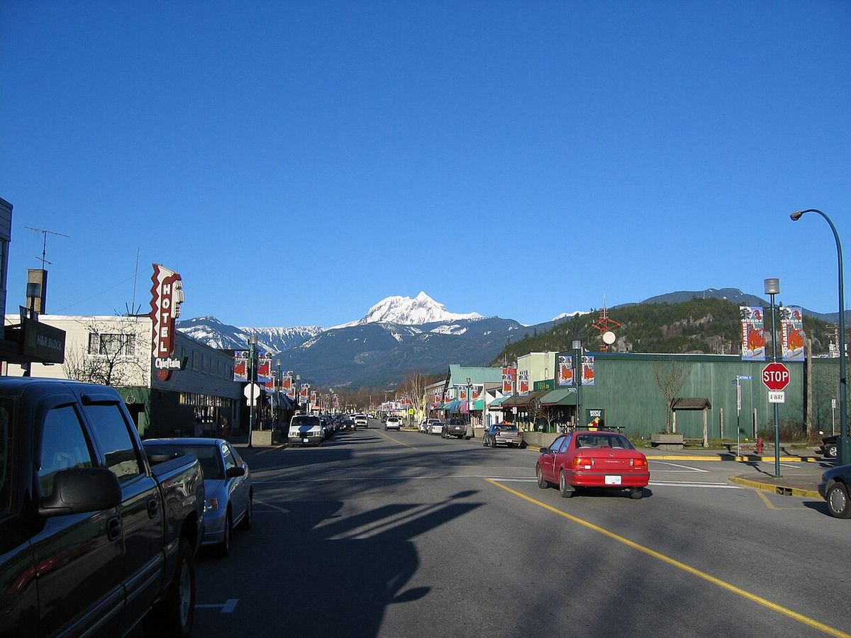
The Stawamus Chief, officially Stawamus Chief Mountain and often called simply The Chief, is a massive granitic dome and provincial park adjacent to the town of Squamish, British Columbia. Rising over 700 metres above Howe Sound, it is one of the world's largest granite monoliths and a site of spiritual significance to the Squamish Nation, who know it as Siy̓ám̓ Smánit. The mountain and its surrounding park form a world-renowned destination for hiking and rock climbing, attracting outdoor enthusiasts from across Canada and globally. Its towering cliffs, distinctive gullies, and three main summits define a dramatic landscape shaped by millions of years of glacial activity.
Geology and Formation
The Stawamus Chief is composed of granodiorite, a granitic rock that formed from molten magma deep underground approximately 100 million years ago during the early Cretaceous period. Its exposure at the surface is the result of tens of millions of years of erosion, with glacial processes dominating over the last 2.5 million years. These powerful glaciers carved the tall, steep walls of the Chief and excavated the fjord of Howe Sound, leaving behind classic signs of their passage such as polished and striated rock surfaces observable even at the summit. The deep gullies separating the mountain's summits were created by fracturing and the mass-wasting of large blocks along deep-seated vertical joints oriented roughly north-south. The Chief may be the root of an extinct volcano, as no volcanic activity occurred in the Squamish area from about 86 million years ago until the onset of Garibaldi Volcanic Belt volcanism roughly 2 to 3 million years ago, which itself ceased during or shortly after the last ice age.
Topography and Physical Features
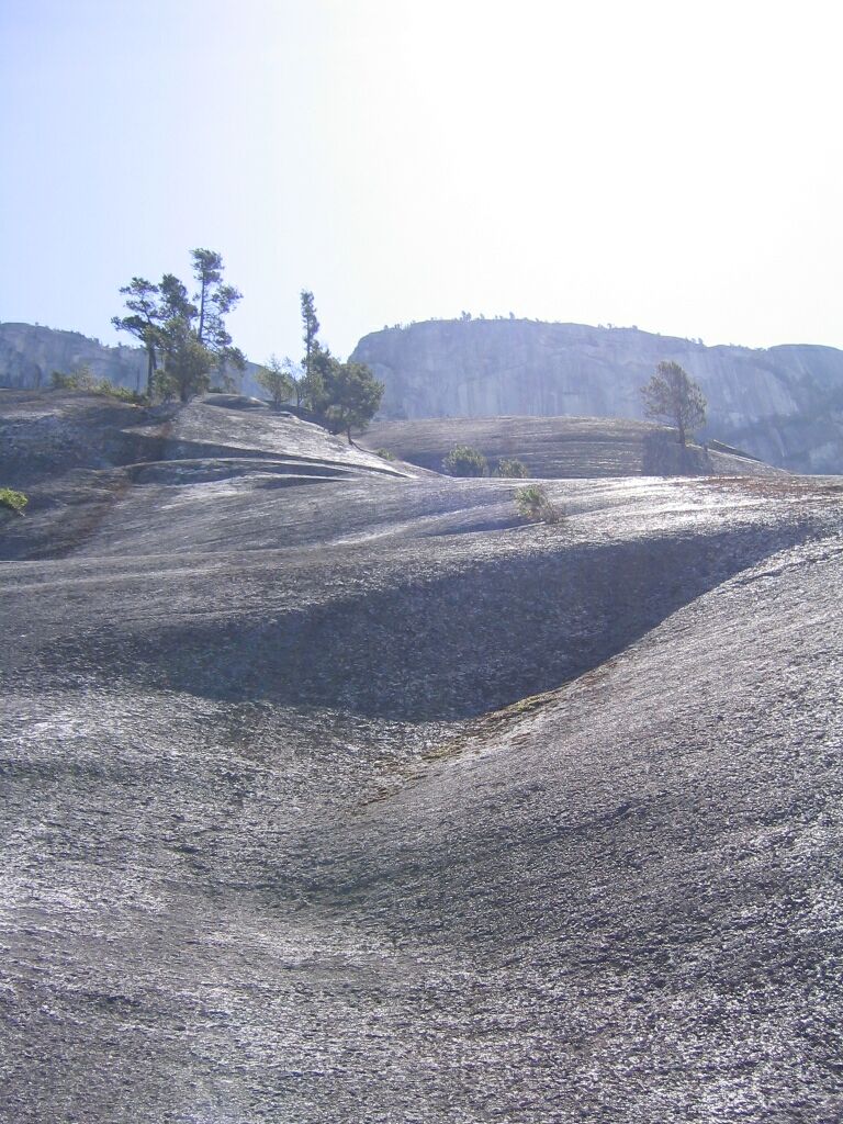
The Chief encompasses approximately three square kilometres of terrain dominated by sheer cliffs and separated by deep clefts. Its most prominent features are its three main summit areas, which offer expansive views and fine glacier-polished granodiorite surfaces. First Peak, or the South Summit, reaches 610 metres, while Second Peak, the Centre Summit, stands at 655 metres. The highest point is Third Peak, the North Summit, at 702 metres, which is more remote, isolated, and less popular with tourists. An additional isolated area north of the main summits is known as the Zodiac Summit, considered a sub-summit of Third Peak and accessible only by faint tracks among the trees with no proper trail leading to it.
The mountain's dramatic profile is defined by its major gullies, which were excavated primarily by glacier action and are partially filled with talus and scree. The South Gully is the largest and most noticeable, separating First and Second Peaks. The North Gully is a dark and narrow chasm that divides Second Peak from the Zodiac Summit, and the even darker and narrower North-North Gully lies between the Zodiac Summit and Third Peak. A smaller, bushier gully near the south end called Bullethead Gully separates the Bulletheads region from the rest of the formation. At the base of the cliffs lies The Apron, a vast sweep of lower-angle rock which rises like a wedge from the highway to about halfway up the Grand Wall, where it meets the Squamish Buttress ridge and terminates at the South Gully.
The forest surrounding the Chief's base and perimeter is a Pacific coastal temperate rainforest, not old growth but representative of the area. Typical tree species are Douglas fir, Western Hemlock, western red cedar, Sitka spruce, and red alder. Also found at the base are numerous medium-to-large granitic boulders, once part of the Chief itself, which form groups explored by bouldering enthusiasts. The largest of these is the Cacodemon Boulder at the base of the Grand Wall, an individual chunk of rock as big as a small apartment building.
Notable Rock Faces and Formations
The Chief's cliffs are high, exposed, and varied in character, offering some of the most famous rock climbing terrain in Canada. The centrepiece is the Grand Wall, a steep and pale wall rising over Highway 99 just south of The Apron. Other significant faces include the Bulletheads region with its oddly rounded bulges near the southern end, and the Dihedral Wall, a featured expanse of rock situated between the Grand Wall and Tantalus Wall. Both the Dihedral and Tantalus Walls serve as nesting areas for peregrine falcons in spring and early summer. The Sheriff's Badge is a distinctive white-coloured, star-shaped exfoliation scar northeast of the Apron, sometimes called 'the Witch' or 'the Bird' by local townsfolk, while the dark and isolated Zodiac Wall marks the northernmost end of the formation.
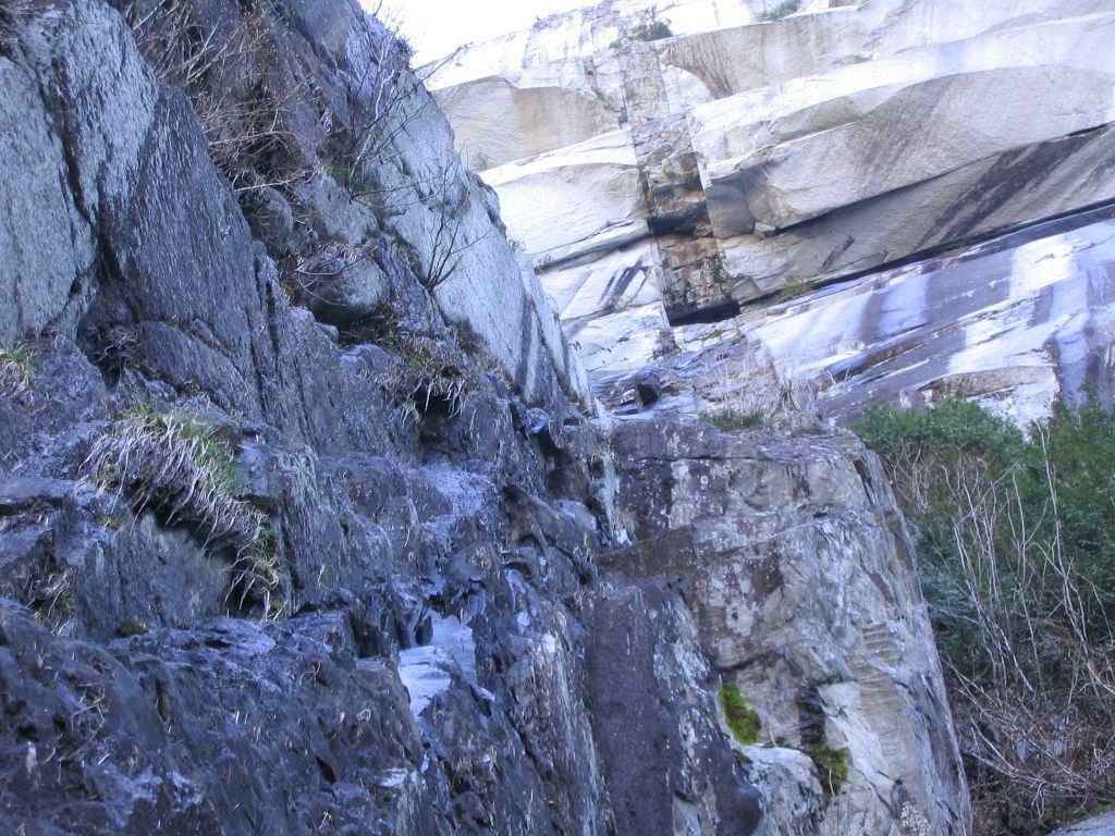
These faces exhibit the unique textural patterns of granitic exfoliation, the natural process by which large flakes of granitic rock shear off in layers rather than crumbling away. A famous example of a partially detached flake is the renowned Split Pillar on the Grand Wall. The rock is characterized by diverse features including overhanging roofs, splitter cracks, rock chimneys, dihedrals, ledges, platforms, and lower angle slabs. A prominent and younger geological feature is the Black Dyke, a vertical intrusion of fine-grained, almost glassy basalt and andesite that divides the Grand Wall from the Dihedral Wall to the south. This dyke formed when magma filled a vertical fracture in the solid granodiorite, possibly feeding volcanoes on the surface above the then-buried rock, and is now clearly visible from the Chief's main parking area.
Rock Climbing History and Significance
The Stawamus Chief, alongside other local climbing areas, has established Squamish as a world-class rock climbing destination, often dubbed 'Yosemite North' for the quality, structure, and composition of its granite, which reportedly resembles Half Dome in Yosemite Valley. The mountain offers almost every style of rock climbing, including traditional climbing, sport climbing, aid climbing, and bouldering, catering to all skill levels, with only alpine and ice climbing not represented due to its sea-level location. The first ascent of the Grand Wall was completed in 1961 by climbers Ed Cooper and Jim Baldwin, an achievement later profiled in Ivan Hughes' 2003 documentary film In the Shadow of the Chief. In the late 1970s, climber Peter Croft began a long and notable career in Squamish, coming to prominence by establishing a number of bold new free climbing routes on the Chief that pushed the limits of what was thought possible at the time.
More recent milestones include Brad Zdanivsky becoming the first quadriplegic to reach the summit on July 31, 2005. In the summer of 2006, Sonnie Trotter established what was at the time considered to be the hardest traditional climbing route in North America, and possibly the world: Cobra Crack 5.14b (8c). Longtime rock climber and Squamish guidebook author Kevin McLane describes climbing at the Chief as featuring immense vertical walls, long cool slabs, sinuous dykes, and beautiful cracks that offer a variety of climbing hard to match anywhere. Also at the base of the Chief's walls are a variety of medium-to-large size granitic boulders, which form groups that have been carefully explored by bouldering enthusiasts.
Hiking, Park Facilities and Access
The Stawamus Chief Provincial Park, established in 1997 by the British Columbia Ministry of the Environment, encompasses over five square kilometres and includes not only The Chief but also the slightly smaller granitic dome of Slhanay located a short distance to the northeast. The park features a walk-in campground and a number of maintained hiking trails which lead through the forest of the Chief's 'backside' to the several summit areas. These trails are steep and rugged, with several high places featuring short sections so steep or slippery that chains and ladders have been bolted to the rock for aid. The summits themselves have no railings or safety installations, making it possible to fall off the face of the cliff, and they offer views of the Sea to Sky Highway and the river below.
- First Peak (South Summit): 610 m (2,001 ft), accessible via maintained trail.
- Second Peak (Centre Summit): 655 m (2,149 ft), accessible via maintained trail.
- Third Peak (North Summit): 702 m (2,303 ft), more remote and isolated, accessible via maintained trail.
- Zodiac Summit: A sub-summit north of Third Peak, reached only by faint tracks among the trees with no proper trail.
Park access was significantly improved with the opening of the Stawamus Chief Pedestrian Overpass in the spring of 2009. This bridge was built as part of the Winter Olympic upgrades of the Sea to Sky Highway. It provides access to the park from a new southbound parking lot in addition to linking the climbing areas of The Chief with those on the granite faces of Malamute Bluffs. The main attraction at the Chief is the large granitic façade which is accessed by the Chief trail or by rock climbing. Several of the Chief's more notable rock faces include the Grand Wall, the Dihedral Wall, and the Tantalus Wall.
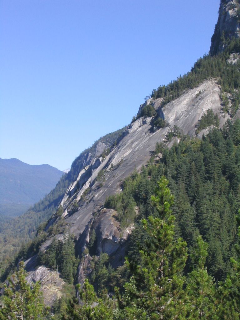
Cultural Significance and Other Activities
The mountain holds spiritual significance for the Squamish Nation, the Indigenous people of the area. Their traditions hold that the mountain, known as Siy̓ám̓ Smánit, is a longhouse transformed to stone by the Transformer Brothers, known in their language as Xáays. The great cleft in the mountain's cliff-face is said in Squamish legend to be a mark of corrosion left by the skin of Sínulhka, a giant two-headed sea serpent. The name 'Stawamus' is derived from the Squamish village (Stʼa7mes) near its foot, as is also the case with the Stawamus River and Stawamus Lake, and the social ranking term Siy̓ám̓ is usually translated as 'chief,' which contributed to the mountain's common English name.
Beyond climbing and hiking, the Chief has become a venue for slacklining, where participants set up tensioned webbing across its gullies. On August 2, 2015, Spencer Seabrooke broke the standing free-solo world record by walking untethered across a 64-metre gap on the Chief. There are over seven different lines that slackliners use in various locations on the mountain, taking advantage of the dramatic gaps between the rock faces. The area's natural beauty and challenging terrain continue to make it a focal point for outdoor recreation in British Columbia, attracting visitors for its combination of natural history, Indigenous culture, and athletic pursuits.
Visitation, Climbing Development and Records
The Stawamus Chief attracts a high volume of visitors annually, drawn by its hiking trails and legendary climbing routes. While precise annual visitor numbers are not officially published, the park's proximity to Vancouver and location along the scenic Sea to Sky Highway make it a consistently popular destination. The climbing community tracks achievements and route development meticulously, with guidebooks like Kevin McLane's The Climbers Guide to Squamish documenting hundreds of established lines. The following table highlights key milestones in the climbing and activity history of The Chief, reflecting its evolution as a testing ground for the sport and other pursuits.
| Year | Event | Person(s) Involved | Significance |
|---|---|---|---|
| 1961 | First ascent of the Grand Wall | Ed Cooper and Jim Baldwin | Pioneering major big wall climb on the Chief. |
| Late 1970s | Establishment of bold free climbing routes | Peter Croft | Pushed contemporary limits of free climbing on the formation. |
| 2005 | First quadriplegic to summit | Brad Zdanivsky | Notable achievement in adaptive climbing on July 31. |
| 2006 | Establishment of Cobra Crack (5.14b) | Sonnie Trotter | Considered hardest traditional climb in North America at the time. |
| 2015 | World record untethered slackline walk (64 m) | Spencer Seabrooke | Record set on August 2 across a gully on the Chief. |
| 1997 | Establishment of Provincial Park | BC Ministry of Environment | Formal protection of over 5 km² including The Chief and Slhanay. |
| 2009 | Opening of Pedestrian Overpass | Built for Olympic upgrades | Improved park access and linked climbing areas with Malamute Bluffs. |
Because of the Chief and several other high-quality climbing areas in the vicinity, Squamish has become a world-class rock climbing destination. Almost every style of rock climbing at almost every possible skill level can be practiced here, including traditional climbing, sport climbing, aid climbing, and bouldering. The park encompasses not only the Chief but also a walk-in campground and a number of maintained hiking trails which lead through the forest of the Chief's backside to several summit areas. At the base and around the perimeter of the Chief are thick forests representative of pacific coastal temperate rain forest common in the area.
Questions about Stawamus Chief
How do you hike to the top of the Stawamus Chief?
The three main summits are accessible via a network of steep and rugged maintained hiking trails on the forested 'backside' of the mountain. These trails involve significant elevation gain and, in several high places, have short sections so steep or slippery that chains and ladders are bolted to the rock for aid. The summits have no safety railings, so hikers must exercise extreme caution near the cliff edges. The highest point, Third Peak at 702 metres, is the most remote and isolated of the three main summits.
Why is the Stawamus Chief important for rock climbing?
The Stawamus Chief is a world-renowned rock climbing destination due to its immense size, high-quality granite, and vast array of routes spanning almost every style and skill level. Often called 'Yosemite North,' its structure and composition reportedly resemble Half Dome in Yosemite Valley. Historic first ascents like the Grand Wall in 1961 and modern test-pieces like the Cobra Crack, established in 2006 and once considered the hardest traditional climb in North America, have cemented its status. Climber Kevin McLane noted its 'immense vertical walls, long cool slabs, sinuous dykes, and beautiful cracks offer a variety of climbing that is hard to match anywhere.'
What is the cultural significance of the Stawamus Chief to Indigenous peoples?
The mountain, known as Siy̓ám̓ Smánit in the Squamish language, is a place of spiritual significance to the Squamish Nation. Their oral traditions say it is a longhouse transformed to stone by the Transformer Brothers, known as Xáays. The prominent great cleft in the cliff face is part of this story, said to be a mark of corrosion left by the skin of a giant two-headed sea serpent named Sínulhka. The name 'Stawamus' is derived from the Squamish village (Stʼa7mes) at its foot, and the term Siy̓ám̓ is a social ranking usually translated as 'chief.'
What other activities can you do at the Stawamus Chief besides hiking and climbing?
Besides hiking and climbing, slacklining has found its way on to the Chief. Slackliners set up across the gullies of the Chief. On August 2, 2015, Spencer Seabrooke broke the standing free-solo world record for walking untethered across a 64-metre gap. There are over seven different lines that slackliners use in various locations on the Chief.
Where is the Stawamus Chief located?
The Stawamus Chief is a granitic dome located adjacent to the town of Squamish, British Columbia, Canada. It towers over 700 metres above the waters of nearby Howe Sound. The mountain is part of the Stawamus Chief Provincial Park, established in 1997, which is over five square kilometres in area. This park encompasses not only the Chief but also the slightly smaller granitic dome called Slhanay to the northeast. The area is a world class rock climbing destination, sometimes called Yosemite North, due to the quality of its granitic rock.
Can you camp at the Stawamus Chief?
Yes, camping is available at the Stawamus Chief Provincial Park, which features a walk in campground. The park, established in 1997, also contains a network of maintained hiking trails that lead through the forest on the mountain's backside to its various summit areas. These trails are steep and rugged, with chains and ladders installed in some sections for aid. The park itself is over five square kilometres and includes not just the Chief but also the neighbouring dome of Slhanay, providing a significant natural recreation area.
Sources and further reading
- Stawamus Chief (Wikipedia)
- Stawamus Chief Park (bcparks.ca)
- Stawamus Chief Provincial Park (exploresquamish.com)
- Stawamus Chief Provincial Park (seatoskyparks.com)
- Stawamus Chief hike near Squamish, BC (vancouvertrails.com)
Checked by the Garbutt Disposal desk. Last updated 2026-10-21.