Great Divide Trail
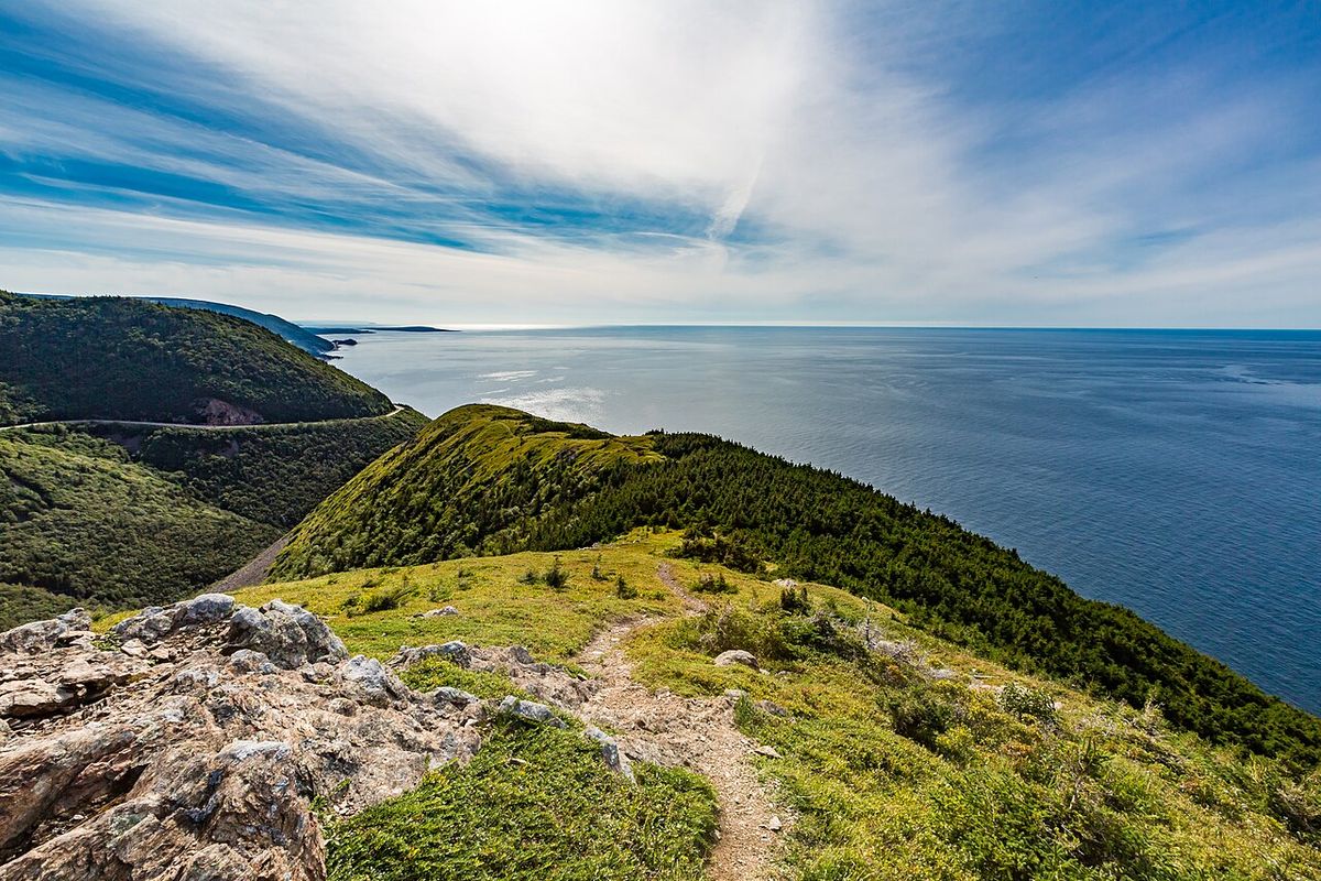
The Great Divide Trail (GDT) is a long-distance hiking route that traverses the Canadian Rockies along the Continental Divide between Alberta and British Columbia. Stretching 1,095 kilometres from the Canada-United States border to Kakwa Lake north of Jasper, the trail is a premier wilderness experience, crossing the divide more than 30 times and passing through five national parks and numerous provincial parks. Managed by the volunteer-driven Great Divide Trail Association (GDTA), the route represents a significant achievement in backcountry trail development and conservation in Canada. While fewer than 100 people complete a thru-hike each year, the trail's popular sections attract thousands of hikers and are central to Canada's outdoor recreation identity.
History and Development
The concept for the Great Divide Trail was first recorded in 1966 when the Girl Guides of Canada proposed a trail running the length of the Alberta-British Columbia border. In 1970, Jim Thorsell published a provisional guide and map for the proposed route, covering roughly the middle half of what would become the modern trail from Palliser Pass to Berg Lake. Parks Canada initially approved the project with a five-year completion goal. Outside the national parks, a dedicated group of six University of Calgary students, including Mary Jane Cox, Jenny Feick, and Dave Higgins, surveyed an estimated 4,800 kilometres of proposed route through public lands in 1974 with support from the Alberta Wilderness Association.
This grassroots effort led to the founding of the Great Divide Trail Association in April 1976, which began trail construction that summer. Despite this momentum, Parks Canada grew concerned about potential overuse and did not advance the project within its jurisdictions. By the mid-1980s, with Alberta government funding, crews had built about 90 kilometres of trail from North Fork Pass to Fording River Pass. When provincial support ended and logging and off-road vehicle use damaged trails, work ceased and the GDTA became inactive for nearly two decades.
The trail was revived in 2000 with the publication of Dustin Lynx's guidebook, Hiking Canada's Great Divide Trail. By 2004, a group called the Friends of the Great Divide Trail began working on the route again, particularly on unprotected Alberta Crown lands. This revival culminated in 2013 with the re-activation of the GDTA as a non-profit corporation based in Calgary. The association has since conducted annual maintenance and trail-building. In a significant step for formal recognition, the GDTA entered into trail management agreements with the British Columbia government in 2022 to 2023, and the trail was officially designated on Alberta Public Lands, with the GDTA becoming its official manager under the Alberta Trails Act.
Route Description and Sections
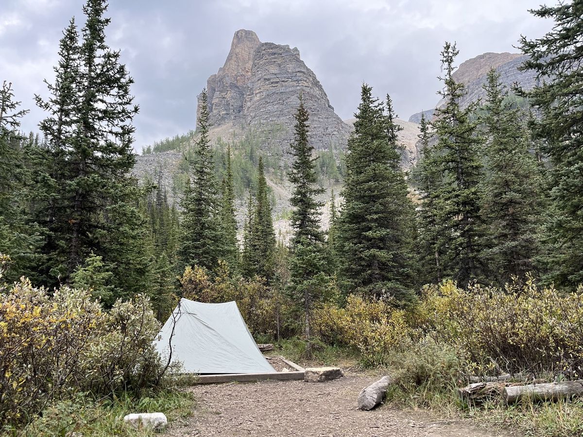
The Great Divide Trail follows a general northwest-southeast alignment through the Continental Ranges of the Canadian Rockies. Its northern terminus at Kakwa Lake is 555 kilometres north and 511 kilometres west of its southern start at the U.S. border. The route is a composite of existing trail systems, ATV tracks, roads, and wilderness routes, varying from well-signed paths to unmarked cross-country travel requiring navigation skills. It passes through five national parks, nine provincial parks, four wilderness areas, and four forest districts. For practical planning, the trail is commonly divided into seven lettered sections, A through G, based on access and resupply points.
Section A covers approximately 145 kilometres from the U.S. border to Coleman, Alberta, near Crowsnest Pass. It travels through Waterton Lakes National Park, an area significantly affected by the 2017 Kenow Wildfire, and includes the trail's second-highest point on Lineham Ridge at 2,520 metres. Section B spans 195 kilometres from Crowsnest Pass to Kananaskis, largely traversing public lands with no designated campgrounds. This section has seen extensive route improvements since 2013, including the construction of the High Rock Trail to avoid private land.
Section C runs 207 kilometres entirely within provincial and national parks from Kananaskis Lakes to Field, British Columbia. It includes popular destinations like Mount Assiniboine Provincial Park and the Rockwall in Kootenay National Park, making campsite reservations highly competitive. Section D is the shortest at 106 kilometres from Field to Saskatchewan River Crossing, featuring substantial stretches of unmaintained trail and significant river crossings. The GDTA has been active here since 2019, maintaining the David Thompson Heritage Trail and installing a cable car over the Blaeberry River.
Section E covers 190 kilometres from Saskatchewan Crossing to Jasper, remaining entirely east of the divide in Alberta. It contains both the trail's highest point (2,590 m) and lowest point (1,055 m). This section mixes remote wilderness with high-use areas like the Skyline Trail near Jasper. Section F is a 100-kilometre segment from Jasper to the junction of the North Boundary and Berg Lake trails at the base of Mount Robson. Its northern end is remote, requiring a 26-kilometre hike to a trailhead.
Geology and Natural Features
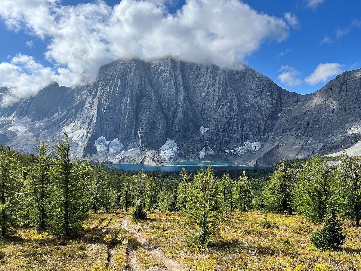
The Great Divide Trail traverses the Continental Ranges of the Canadian Rockies, which are composed predominantly of sedimentary rock like limestone, shale, and quartzite from the Neoproterozoic to Cretaceous periods. This contrasts with the older granite and gneiss common in the American Rockies. An exception is found in Waterton Lakes National Park, which contains some of the oldest rock in the Canadian Rockies from the Purcell Supergroup. The trail's geology creates a region of deep, glacially carved valleys and steep mountain walls, giving the peaks along the divide great prominence despite generally lower elevations than their American counterparts. The route passes numerous significant geological and natural landmarks.
- Upper Waterton Lake: The deepest lake in the Canadian Rockies at 148 metres, formed by glacial action at the southern terminus.
- Mount Assiniboine: A glacial horn rising to 3,618 metres, often called the 'Matterhorn of the Rockies'.
- Burgess Shale: Fossil beds in Yoho National Park containing exceptionally preserved fossils over 500 million years old.
- Maligne Canyon: A karst slot canyon up to 55 metres deep, located just off the trail in Jasper.
- Maligne Lake: The longest natural lake in the Canadian Rockies at 22.3 kilometres, formed by glacial retreat.
- Mount Robson: The highest peak in the Canadian Rockies at 3,954 metres, located near the trail in Section F.
- Karst systems: Extensive networks of caves and sinkholes in the Palliser Formation around Jasper, including caves at Cataract Valley.
The Burgess Shale in the Waputik Mountains of Yoho National Park contains fossils of soft-bodied organisms dating to over 500 million years ago. From his discovery of the fossils in 1909 until 1924, Charles Walcott collected 65,000 specimens from this formation. The vast diversity of these exceptionally well-preserved fossils has been highly informative to paleontology and paleoclimatology. Other examples of dramatic water-carved geology directly on the GDT include Turbine Canyon in Peter Lougheed Provincial Park and Mistaya Canyon, which is cut into the Eldon Formation in Banff National Park.
Climate and Hiking Season
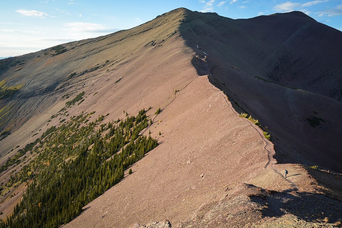
The Continental Ranges experience a continental climate with wide seasonal temperature variations and moderate precipitation, generally higher on the British Columbia side of the divide. The trail is typically snow-covered until June, with snow lingering on northeast-facing slopes into July due to less sunlight and deeper drifts from prevailing westerly winds. The primary hiking season runs from early July to early September, when the trail is nearly snow-free. July is the warmest month, with daytime highs often between 20°C and 30°C, while June tends to be the wettest. Mountain weather is highly variable along the GDT due to significant elevation changes and differing valley orientations.
Temperatures drop approximately 0.7°C for every 100-metre gain in elevation. Afternoon thunderstorms with hail are common on hot July and August days. By September, precipitation at higher elevations often falls as snow, and overnight temperatures in the valleys can approach freezing. Thru-hikers typically require between five and ten weeks to complete the entire trail, with an average pace of about seven weeks. This schedule must account for the variable conditions, from potential early-season snow to late-season cold snaps, and hikers must be prepared for sudden weather changes in any month.
The Great Divide Trail Association and Community
The Great Divide Trail Association is the non-profit organization responsible for the trail's stewardship, promotion, and management. Headquartered in Calgary, it reported having 893 active members in 2026. The GDTA's work includes annual trail maintenance, building new sections, publishing guidebooks and maps, and providing extensive online trip-planning resources that are updated yearly. A landmark achievement was the association's official designation as trail manager under the Alberta Trails Act following agreements with the provincial governments of Alberta and British Columbia in 2022 to 2023. The GDTA fosters a strong community through events and outreach.
- Trail Days 2026: The inaugural festival from June 12-14 in Crowsnest Pass, celebrating the GDTA's 50th anniversary.
- Founding Members Panel (2026): Featured original members Dave Higgins, Jenny Feick, and Jeff Gruttz, alongside revival figures Wayne Marshall and Dan Wallace.
- Calgary Social Event: A gathering at Prairie Dog Brewing on October 15, 2026, for hikers to share stories.
- Annual Resources: Publication of updated maps, campground guides, and itineraries for each hiking season, like the 2026 calendar and special edition wall maps.
- Key Trail Projects: Construction of the High Rock Trail in Section B and maintenance of the David Thompson Heritage Trail in Section D.
- Collaborative Maintenance: Work with Parks Canada since 2022 to clear deadfall and renovate campgrounds on the Maligne Valley trail in Section E.
Since its revival in the early 2000s, the Great Divide Trail Association has conducted annual maintenance and trail-building throughout the length of the GDT. The association entered into agreements with the British Columbia government on trail management and resupply in 2022 and 2023. In the following year, the GDTA became the official trail manager for the Great Divide Trail under the Alberta Trails Act. By 2026, the GDTA reported that it had 893 active members, fostering a dedicated network of volunteers and enthusiasts.
Planning a Thru-Hike
Thru-hiking the Great Divide Trail is a significant undertaking that requires careful preparation due to its remote nature, variable conditions, and logistical challenges. Fewer than 100 individuals complete the entire trail each year. Hikers must be proficient in wilderness navigation, as long sections are unmarked or follow unofficial routes. Essential skills include map and compass use, river crossing techniques, and bear safety knowledge. The GDTA provides comprehensive, annually updated resources on its website, including detailed maps, campground information, suggested itineraries, and permit guidelines. Permit requirements vary significantly by section.
Hikers must secure backcountry camping permits for all travel within the five national parks the trail traverses: Banff, Jasper, Kootenay, Yoho, and Waterton Lakes. Permits are also required for provincial parks like Mount Assiniboine. These can be highly competitive, especially for popular areas in Section C, and must be booked months in advance. Other sections, like much of Section B and parts of Section E, traverse public land where no specific permits are required, offering more flexibility. Resupply strategy is a critical component of planning.
The trail passes near or through several towns and hamlets where hikers can restock food and gear. Key resupply points include Coleman, Kananaskis Lakes, Field, Saskatchewan River Crossing, and Jasper. The distances between these points can be substantial, requiring careful calculation of food carries. The GDTA's agreements with the BC government have also helped formalize resupply options. Hikers must also prepare for variable trail conditions, from well-maintained paths to overgrown tracks and unbridged river crossings, particularly in Sections D and E where the trail is least developed. Handling these sections often requires route-finding skills and a tolerance for challenging terrain.
Questions about Great Divide Trail
How long does it take to hike the entire Great Divide Trail?
Completing the entire 1,095-kilometre Great Divide Trail typically takes between five and ten weeks. Most hikers travelling at an average pace require about seven weeks to finish the journey. The primary hiking season is from early July to early September, when the trail is mostly free of snow. The duration depends on an individual's fitness, pace, weather conditions, and the time spent on resupply and rest days in towns along the route.
Do I need permits to hike the Great Divide Trail?
Permit requirements vary by section. Backcountry camping permits are mandatory for all overnight stays within the five national parks the trail traverses: Banff, Jasper, Kootenay, Yoho, and Waterton Lakes. Permits are also required for provincial parks like Mount Assiniboine. These can be highly competitive and must be booked well in advance. Other sections, such as much of Section B through public lands, do not require specific permits. Hikers must research each section individually using the GDTA's annual resources.
What is the Great Divide Trail Association?
The Great Divide Trail Association (GDTA) is the non-profit organization that manages, maintains, and promotes the trail. Founded in April 1976 and re-activated in 2013, it is headquartered in Calgary and had 893 active members in 2026. The GDTA conducts trail work, publishes guidebooks and maps, provides trip-planning resources, and advocates for the trail's protection. In 2022 to 2023, it became the official trail manager under the Alberta Trails Act following agreements with the provincial governments.
What are the biggest challenges of hiking the GDT?
Major challenges include navigation on unmarked or unmaintained sections, particularly in the more remote parts of Sections D and E, which require strong wilderness skills. Logistical hurdles involve securing competitive camping permits for popular national parks and planning resupplies over long distances. Physical challenges encompass significant elevation gain and loss, unpredictable mountain weather, and unbridged river crossings. The trail's remoteness also demands self-sufficiency and preparedness for emergencies.
How is the Great Divide Trail marked and maintained?
The trail is only officially signed as the GDT in portions of Sections A, B, D, and G. Elsewhere, it follows existing trail networks within parks that are well-marked but not identified as the GDT. Maintenance is a collaborative effort. The GDTA organizes volunteer crews for annual work, and Parks Canada maintains trails within national parks. Since 2022, Parks Canada has renewed maintenance on sections like the Maligne Valley trail. The condition varies from developed paths to rough, unmaintained wilderness routes.
Where does the Great Divide Trail start and end?
The Great Divide Trail starts at the Canada-United States border in Waterton Lakes National Park, where it connects with the Continental Divide Trail. Its northern terminus is at Kakwa Lake, north of Jasper National Park. The trail runs generally northwest for 1,095 kilometres, closely following the Continental Divide between Alberta and British Columbia. It crosses this provincial boundary more than 30 times along its entire length. The northern terminus is 555 kilometres further north and 511 kilometres west of the southern starting point.
Sources and further reading
- Great Divide Trail (Wikipedia)
- Trail Days 2026: 50 Years of Wild (greatdividetrail.com)
Checked by the Garbutt Disposal desk. Last updated 2026-10-25.